
Chiricahua Mountains…ancient homeland of the Apache, sky island, “Land of Standing-up Rock”? The Chiracahuas are all this and so much more.
As I walked among the towering hoodoos I marveled at the fact that we spent 25 years of our lives in Phoenix and Sedona and had never traveled to the Chiracahuas, being the hikers we are. Granted, it is not a short jaunt across town, just 50 miles north of the Mexico border, but the mountains are so breathtaking and the history of the area so rich, I’m not sure why we waited. Perhaps we just needed to be a little more seasoned to appreciate all that is here.
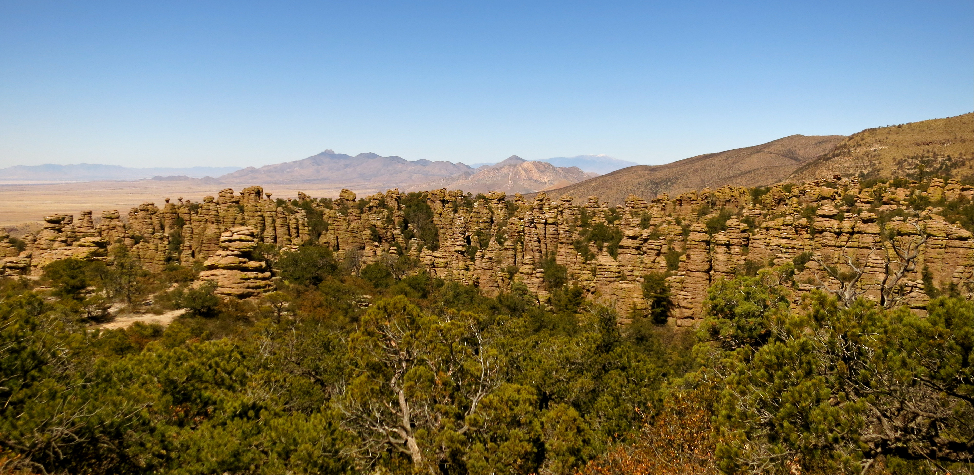
The Chiracahua Mountain range had its origins roughly 27 million years ago, when eruptions from the Turkey Creek volcano spewed ash over 1200 square miles. This sky island, which is essentially an isolated mountain range rising above a grassland sea, developed over many millenia into the rock pinnacles that we see today. They stand like guardians of the forest and send the clear message that you are now in Chiracaqua country.


The Chiracaqua Apache claim this land as their ancestral home, with evidence of their existence in these mountains dating back to the early 1400’s. They named this range the “Land of the Standing-Up Rock” and lived peacefully here until the Europeans stepped in to declare this land theirs. Led by Cochise and Geronimo, the Apache staunchly defended their ancestral homeland. The last of the Apache finally gave up the fight in 1886, surrendered, and were later relocated by the government to Oklahoma and New Mexico, never to return to this sacred land. So much more could be said here but I will just add that I felt a sadness as I walked the trails, reflecting upon all the Native Indians have so unjustly lost .
There is such an interesting blend of local and exotic plant and animal species here that it is said to be one of the most biodiverse regions in North America, boasting over 1200 species of plants alone. Plants and animals from four different ecosystems come together in this range. Birders flock here for the diversity as well, seeing many species of birds that can normally only be seen in Mexico. We visited for the hiking, to witness Mother Nature at her finest, rock formations precariously balanced in such a way that it appeared a strong wind could topple these giants.


Chiracaqua National Monument was established in 1924 to preserve and protect these 12,000 acres and in 1934 the Civilian Conservation Corps began to tackle the job of roads and trails. Today there are ~20 miles of trails for your hiking pleasure and 86% of this sky island lives on as pristine wilderness.
To experience as much of the Chiracaquas as we could in one visit, we chose the Big Loop, a combining of many trails that resulted in a lovely 10-mile hike. There are a few ways you can tackle this trail and, based on a tip provided to us by a Park Ranger at Fort Bowie the day before, we elected to take the shuttle from the visitor center to the Echo Canyon Trailhead (arrive prior to 8:30 am). From there we followed this route: Echo Canyon Trail> Hailstone Trail > Mushroom Rock Trail > Big Balanced Rock Trail > Heart of Rocks Loop (where most of the named formations stand) > Sarah Deming Trail > Lower Rhyolite Canyon Trail. This and a little other meandering will get you a fabulous 10-mile hike, with the last three miles being downhill. 🙂
Heart of Rocks Loop:


Wandering among these geologic wonders that time and weather have painstakingly created, you just might feel the spirits of the ancient ancestors who walked this ground…truly a sacred experience.
If you liked this blog post, why not scroll up to ‘Follow Us’ and enter your email address? You just might find something that interests you.
