Desert Sanctuary ~ Cibola National Wildlife Refuge, AZ

This past weekend we made a quick trip to Yuma where we met up with our new travel buddy, an Arctic Fox truck camper. After much research we decided upon this mode of travel as we begin our tentative plans to tour Alaska next year. We are also planning to take this little guy out when we hit the road in a couple of months just to see how living in it will feel for several months. This should be interesting. 😉 Actually, it does have one slide-out so it is roomier than one might think. Put some solar on top and we are good to go!

Our cute little Fox!

Cibola National Wildlife Refuge was on my radar after reading the great post Nina had written on this desert sanctuary so we headed that way once our business in Yuma was complete.  With BLM land right across from the visitor center, it was the perfect place to enjoy our first night in the cozy confines of our little Fox.

Canada and snow geese still grace the ponds.
White pelicans, one of my favorites!

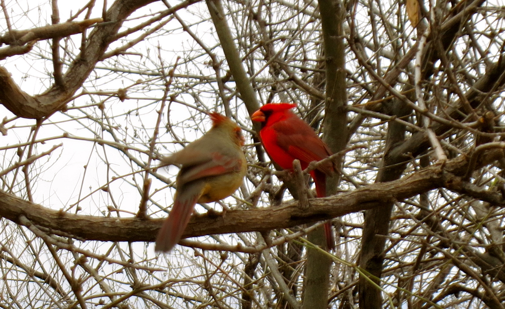
Cibola’s 16,600 acres sit in the lower Colorado River floodplain, a green swath of land tucked into the desert between Arizona and California.  This greenbelt is a major flyway for migrating birds, and many songbirds’ diets rely on the insects that are attracted to the flowering honey mesquite trees in the area.  Thanks to an arrangement with some of the local farmers, harvested corn fields draw many species of birds and other wildlife as well…plant them and they will come. 🙂  The sandhill crane population, mid-December through mid-January, can often number 2,000 birds.  They were rather elusive during our visit and reduced in number, off in a field not accessible to the public. We were content to be voyeurs and gaze from a distance, listening to their unusual vocal callings, since we had a close encounter with these beauties last winter near Fort Pierce, FL.

An adorable burrowing owl kept his eye on my every move.
A field full of yellow-headed blackbirds, a new sighting for me.

It was fortuitous that this little adventure came together when it did, as we had wanted to meet up with fellow RVers and bloggers Rick and JoAnne, volunteers at Cibola through the end of February.  They were just as lovely as we had been told by others, and we enjoyed some snacks and a nice bottle of wine while getting to know them better.  The added bonus was meeting Joe and Murlene, also volunteers, who led us into the refuge as they found us sitting alongside the road planning our route.  Joe very kindly took us on a private tour, pointing out many of the local waterfowl and other wildlife that make this their winter home.  I learned through Nina’s post of Cibola and talking with Joe that he has an extensive background as a photographer, one that he refers to as a hobby but looks to rival most professionals imho.  Check out his website here and see for yourself the beauty he so artfully captures in nature.

The waterfowl are dwindling as they begin to feel the call of cooler climes but there is still much to seduce your senses.  Summer here in the desert can be harsh, when temps can soar to 120° F.  Soon the ponds will be quieted, where there was a cacophony of sounds just weeks ago, with standing-room only.

Cibola Cabin, home to Carl Bishop, until the river overflowed its banks.

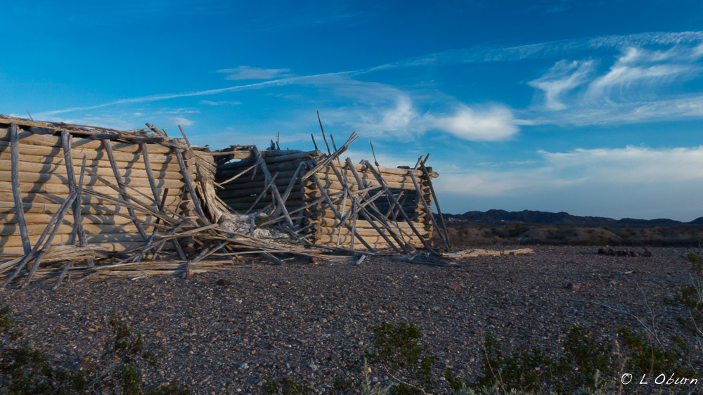
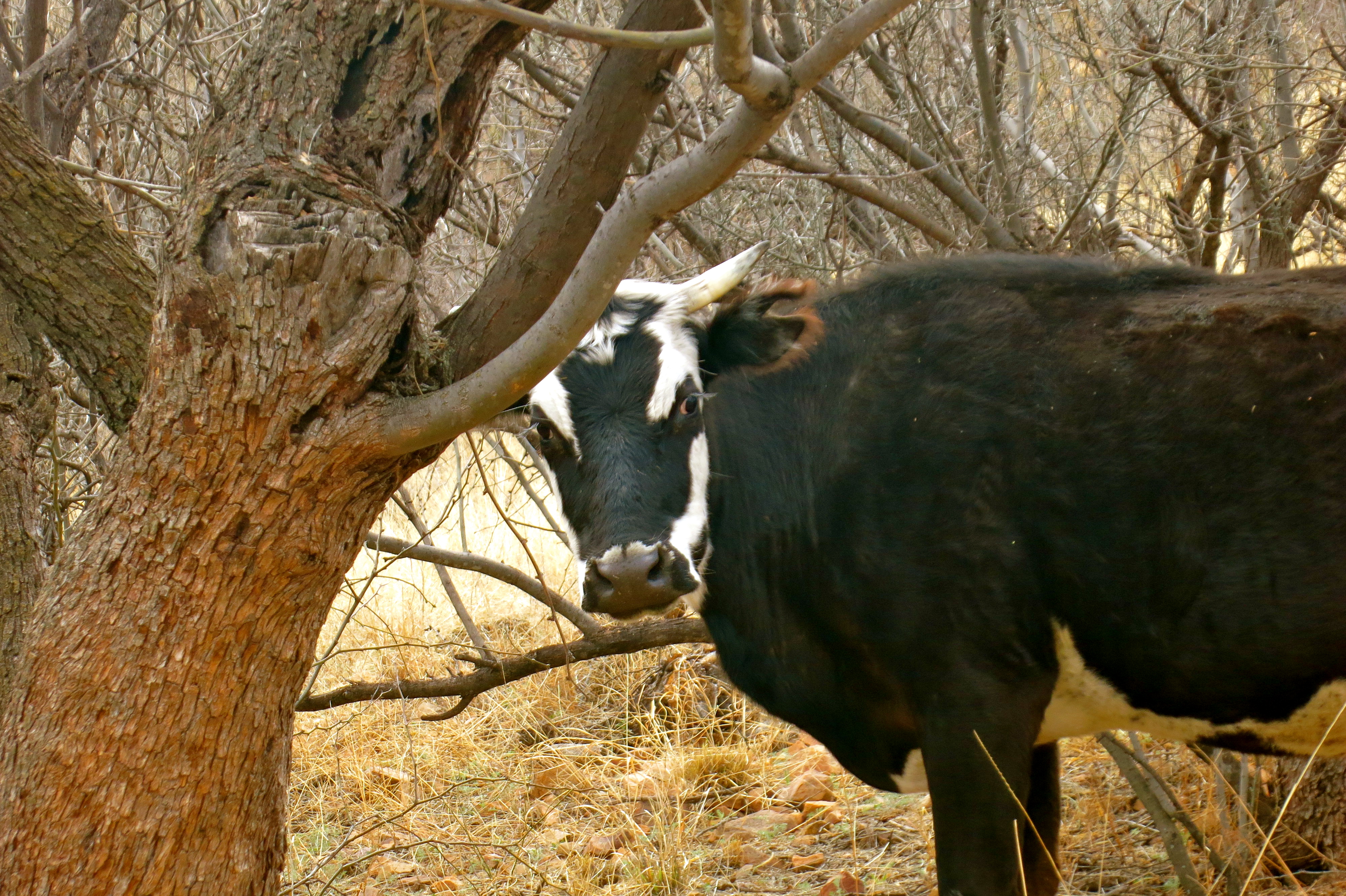
When you tire of all the colorful wildlife, just down the road from the ponds is the historic Cibola Cabin and Hart Mine.  You might just find a few wild burros foraging in the desert if you are lucky.

Peak time for visiting is mid-December through mid-January but we still found this little desert oasis delightful.  If you find yourself wandering in the desert between Blythe and Yuma, consider a visit to Cibola National Wildlife Refuge, a sparkling little desert gem. 🙂

Last rays against a desert mountain backdrop.

Red Rock Energized ~ Sedona, AZ

Sedona has long held the reputation as a world-wide spiritual mecca, drawing healers, artists, and spiritual guides.  Whether or not you believe in her vortex energy, there is no denying the breathtaking views that can be seen in every direction. Having lived in Sedona for many years, we believe the magnificent red rock formations and evergreen vegetation exudes energy, a year-round feeling of renewal and sense of peace, and is one of the reasons we come back year after year to hike her enchanting trails.

We recently found ourselves back in Sedona to visit friends, get a tune-up for me, and do a little hiking.  Dead Horse Ranch State Park in Cottonwood is where we tend to stay, a peaceful park that is just far enough away from the tourist pace of Sedona, yet close enough to hiking trails.  Finding a trail we haven’t already tackled is the biggest challenge, particularly Terry, who I think has pretty much hiked them all.  I did manage to introduce him to a newer trail that I hiked a few years ago with a girlfriend and he agreed to tag along with me on one that I had yet to cross off my list.

Here are two hikes we would highly recommend should you find yourself wandering around Sedona’s red rocks:

1)  Slim Shady / Highline / Baldwin / Templeton (with a twist)

Better known by many as the Highline Trail, this was actually designed as a technically difficult mountain biking trail but is equally loved by hikers.  It is a bit of a challenge to stay on course as many trails converge at one point or another.  And with such breathtaking scenery to distract you, you may as well decide you are going to get turned around a time or two.

Views of one of the most-photographed sights in Arizona, Cathedral Rock, can be seen from many angles, and we soon found ourselves getting off our charted course to see if we could pick up a trail that would take us to the highest saddle point on Cathedral Rock.  There is a designated, slick rock trail up to the saddle point but it was on the opposite side of Cathedral Rock from where we were.  But did that stop us?  Nope!

Although we would not suggest this as the soundest or safest way to get to the saddle of Cathedral Rock, what with the bush-whacking and boulder-hopping, it was certainly a unique approach.  What began as a moderate 5-miler ended as a very interesting 9-mile hike.

Our next day’s adventure was to be a bear and Terry’s all-around favorite Sedona hike.  After tackling this mountain, I had to agree.

2)  Bear Mountain

I’m not sure why I never hiked this mountain while we lived in Sedona, as it has always been touted to have some of the most breathtaking views from its peak.  I had decided this visit was the time and I wasn’t leaving Sedona until I had firmly planted my feet on top.  All I can say is wow!

Bear Mountain is a 5-mile hike with a 2000 foot elevation gain over some of the most unusual topography in Sedona.  There are cairns to mark part of your journey but white arrows painted onto the rocks are your true guides to the peak.  There are interesting breaks or decks of changing geology that you pass through, almost as if you traverse three false summits before reaching the true peak.  A section of Apache Limestone moves into Schnebly Hill Sandstone, then onto a deck of swirling Coconino sandstone dotted with manzanita, truly spectacular.

Sedona’s grandeur can be seen without taking to the trails, but we have always believed that the essence of her spirit lies off the paved roads, tucked back into her hidden canyons.

We have settled into our winter home in Southern California, which I will post about in the near future.  It is a change from our existing approach to RVing and we are enjoying it more than I had imagined.  More on that later…

An Ancient Landscape ~ Petrified Forest National Park, AZ

Recently, while on a trajectory back to Sedona, AZ, which was home to us for several years, I realized that Petrified Forest National Park was within striking distance.  It had been many years since we had last visited so an overnight stay was added to our itinerary.

Petrified Forest National Park, in northeast Arizona, encompasses roughly 150 miles of brightly hued, abraded badlands, an ancient landscape that was birthed over 225-million years ago. Wind and water transformed this once humid, sub-tropical land, along with tectonic forces that pushed the landscape upward, exposing the Colorado Plateau to immense erosion.  Today, these desolate but beautifully striated formations tell the story of a land that has been scattered on the winds and the remains of trees now dot the landscape, turned to stone, as if Medusa had been at work here.

The Tepees
The Tepees

Petrified Forest is the only national park to protect a section of historic Route 66.  The roads are well-maintained so larger vehicles/RV’s can easily maneuver the 28-mile scenic drive through the park.  If your visit is short as ours was, the Crystal Forest Gift Shop Campground at the southern entrance is the place to stay.  Although you will be dry-camping, you will also be staying there free of charge. 🙂

The Painted Desert lies far off in the distance.
The Painted Desert lies far in the distance.
Newspaper Rock, where ancient words are etched onto desert varnish.
The sun peering through clouds over the Petrified Forest
Final rays cast a golden glow over the desert, with petrified wood strewn across the landscape.

Chiracahua Mountains ~ Hoodoo You Think You Are?

Chiricahua Mountains…ancient homeland of the Apache, sky island, “Land of Standing-up Rock”?  The Chiracahuas are all this and so much more.

Chiracahua Mountain Range

As I walked among the towering hoodoos I marveled at the fact that we spent 25 years of our lives in Phoenix and Sedona and had never traveled to the Chiracahuas, being the hikers we are.  Granted, it is not a short jaunt across town,  just 50 miles north of the Mexico border, but the mountains are so breathtaking and the history of the area so rich, I’m not sure why we waited.  Perhaps we just needed to be a little more seasoned to appreciate all that is here.

The Chiracahua Mountain range had its origins roughly 27 million years ago, when eruptions from the Turkey Creek volcano spewed ash over 1200 square miles.  This sky island, which is essentially an isolated mountain range rising above a grassland sea, developed over many millenia into the rock pinnacles that we see today.  They stand like guardians of the forest and send the clear message that you are now in Chiracaqua country.

The Chiracaqua Apache claim this land as their ancestral home, with evidence of their existence in these mountains dating back to the early 1400’s.  They named this range the “Land of the Standing-Up Rock” and lived peacefully here until the Europeans stepped in to declare this land theirs.  Led by Cochise and Geronimo, the Apache staunchly defended their ancestral homeland.  The last of the Apache finally gave up the fight in 1886, surrendered, and were later relocated by the government to Oklahoma and New Mexico, never to return to this sacred land. So much more could be said here but I will just add that I felt a sadness as I walked the trails, reflecting upon all the Native Indians have so unjustly lost .

There is such an interesting blend of local and exotic plant and animal species here that it is said to be one of the most biodiverse regions in North America, boasting over 1200 species of plants alone.  Plants and animals from four different ecosystems come together in this range.  Birders flock here for the diversity as well, seeing many species of birds that can normally only be seen in Mexico.  We visited for the hiking, to witness Mother Nature at her finest, rock formations precariously balanced in such a way that it appeared a strong wind could topple these giants.

Chiracaqua National Monument was established in 1924 to preserve and protect these 12,000 acres and in 1934 the Civilian Conservation Corps began to tackle the job of roads and trails.  Today there are ~20 miles of trails for your hiking pleasure and 86% of this sky island lives on as pristine wilderness.

To experience as much of the Chiracaquas as we could in one visit, we chose the Big Loop, a combining of many trails that resulted in a lovely 10-mile hike.  There are a few ways you can tackle this trail and, based on a tip provided to us by a Park Ranger at Fort Bowie the day before, we elected to take the shuttle from the visitor center to the Echo Canyon Trailhead (arrive prior to 8:30 am).  From there we followed this route:  Echo Canyon Trail> Hailstone Trail > Mushroom Rock Trail > Big Balanced Rock Trail > Heart of Rocks Loop (where most of the named formations stand) > Sarah Deming Trail > Lower Rhyolite Canyon Trail. This and a little other meandering will get you a fabulous 10-mile hike, with the last three miles being downhill. 🙂

Heart of Rocks Loop:

Wandering among these geologic wonders that time and weather have painstakingly created, you just might feel the spirits of the ancient ancestors who walked this ground…truly a sacred experience.

If you liked this blog post, why not scroll up to ‘Follow Us’ and enter your email address?  You just might find something that interests you.


“Preposterously Beautiful” ~ Patagonia, AZ

This is the way part-time resident, novelist and screenwriter (Legends of the Fall) Jim Harrison describes Patagonia.  We just blew through this funky little town several years ago when we visited so we decided it was time to show her some respect.

Our good friends Stan and Marilyn were hunkered down here for a few days while a winter storm passed by and we wanted to see them one last time before they began their journey back home.  Even though the weather wasn’t perfect, what better place to enjoy nature for a few hours than in a world-class birding hot spot.  Even if you are not a birder, once here we are told, you may discover your inner passion for these colorful, feathery creatures who far outnumber people. This little gem has been named in the publication Fifty Places to Go Birding Before You Die:  Birding Experts Share the World’s Greatest Destinations.

Bridge over Patagonia Lake

Nestled between the Santa Rita and Patagonia Mountains at a 4000-foot elevation, this town has a unique vibe, a quirkiness about it that suits its residents just fine.  Preserving its history, its rich riparian area, and sustainability are some of Patagonia’s top priorities.

Just west of town lies the Patagonia-Sonoita Creek Preserve, “home to one of Arizona’s few permanently flowing streams, endangered fish, butterflies, and birds”.  Adjacent to town the Nature Conservancy has also staked its claim and the organization Native Seeds/SEARCH maintains a farm for preserving and growing seeds of endangered crops that grow in this area.  Scratch below the surface, dig a little deeper, and you will find some hidden gems in small town America.  We will definitely be back.

Patagonia Lake
Patagonia Lake

Although I have bemoaned the fact that I need a camera with better zoom ability to catch the beauty of these little feathered friends, we headed out to Patagonia Lake State Park & Sonoita Creek Natural Area with binoculars in hand (and camera just in case I got lucky).  Our first stop was to the visitor center to ask where the most birds can be seen.  Many agreed that if we stood in their side yard, where their feeders are, we would see a wide variety, but they also decided to share a couple of trails that might offer some enjoyment.  We opted for the birding trail, sans tour guide, where we could get a little exercise and hopefully see some birds.

A pair of cardinals hiding in the thicket

For the record, I am not a birder, but I must admit to sending out a little prayer into the universe to have a chance meeting with the reclusive Elegant Trogon, the colorful, tropical bird that brings birders by the thousands to southeast Arizona each year.  Patagonia and its surrounding  mountain ranges are the farthest north this little beauty ventures so I wasn’t very optimistic about my chances.

Who are you lookin' at?
Who are you lookin’ at?

The first mile didn’t offer much to entice our sense of sight, other than some inquisitive cows, a burbling creek and the sound of many bird species that filled the air.  We were relishing the fresh air after being cooped up inside waiting out the winter storm.  Following the creek around a bend, our friend Marilyn whispered, “there he is”.  The gods were smiling down on us as we watched this little beauty quietly perched on a branch.  I kept snapping away in the hopes of having a few viable photos then traded off with Terry so I could see him in all his splendor up-close through the binoculars.  Terry was able to creep even closer when the Elegant Trogon flew from his perch to the ground and back up again. Here is what he found to be much more interesting than us:

The big question from everyone we met on the trail was “did you see it?”.  We showed our photos many times before we got back to our vehicle.  We were ready to take off when someone tapped on Stan’s window.  Rolling it down, the group standing there asked to see the photos.  Guess this colorful little fella is something of a rock star!

Our time with Stan and Marilyn was coming to an end, and what better way to find solace than to nourish our bodies and toast this heart connection with a glass of nice French wine.  We headed over to the Velvet Elvis Pizza Company, where the lovely Ecuadorian proprietor and executive chef, Cecilia, creates the most delectable dishes.  Her pizzas are gourmet and the remaining menu has a Latin American flair.  What a find in this funky little town and the perfect way to bid adieu to our friends, with the promise of a visit later this summer.

"Last supper" at the Velvet Elvis
“Last supper” at the Velvet Elvis

For a great gallery of Arizona birds, check out the Lowe’s RV Adventures, and while you’re there, spent some time reading about their many wonderful travel exploits.

If you liked this blog post, why not scroll up to ‘Follow Us’ and enter your email address?  You just might find something that interests you.