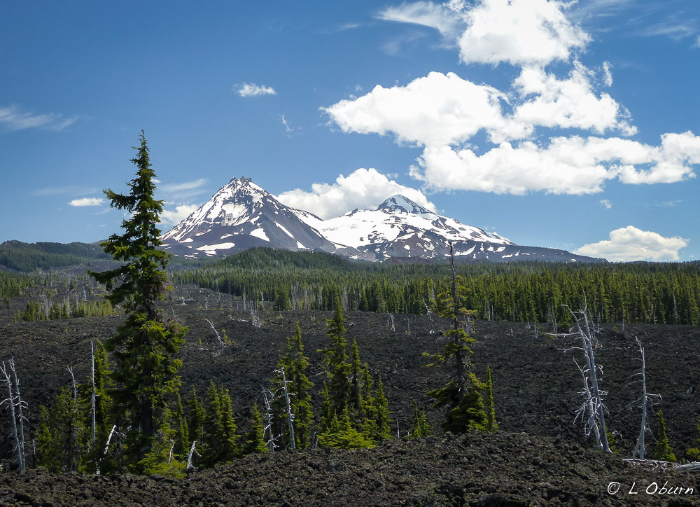
You know you’re in for a special treat when the view that greets you as you approach town is an impressive skyline of snow-capped peaks. Welcome to Sisters, where the town’s namesakes, North, South, and Middle Sister Peaks, all towering over 10,000 feet, grace the horizon, literally rising out of her backyard. Complimenting this imposing panorama are Mt. Jefferson, Mt. Washington, Broken Top, and Three-Fingered Jack, quite a sight to behold.
As Oregon’s highways better developed, Sisters became known as the Gateway to the Cascades. She has retained her Old West flair while having a healthy tourist side, sporting specialty shops, antique stores, galleries, coffee shops, and restaurants. Our favorite store was Jeffrey Murray Fine Art Photography. His landscape photography drew us in and we learned after visiting with Jeffrey that many of the photos in his gallery were taken during his 5-year sojourn as a full-time RVer. This talented young artist now calls Bend home. You can check out his artistry here.

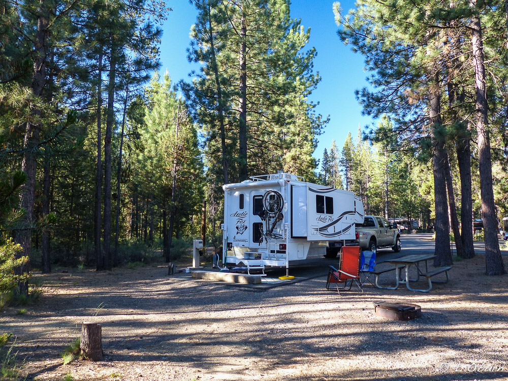
Since we began our summer travels on May 1st, I have marveled at the places we have been able to squeeze our little Fox into, roads we have traveled, and stops we have made that we would not have attempted with our 5th-wheel. But there are places that even a truck camper should not venture, as we learned during our time in Sisters.
We planned to hike Black Butte and our home was coming with us so decent forest service roads to the trailhead were a must. After only one mile of a 5-mile drive, having been sufficiently bounced around by potholes and constant washboard surface, we reluctantly turned around and moved to Plan B, which became the 82-mile loop drive from Sisters, the McKenzie-Santiam Pass Scenic Byway. It sounded wonderful, and it was, with a few little twists and turns. 😉

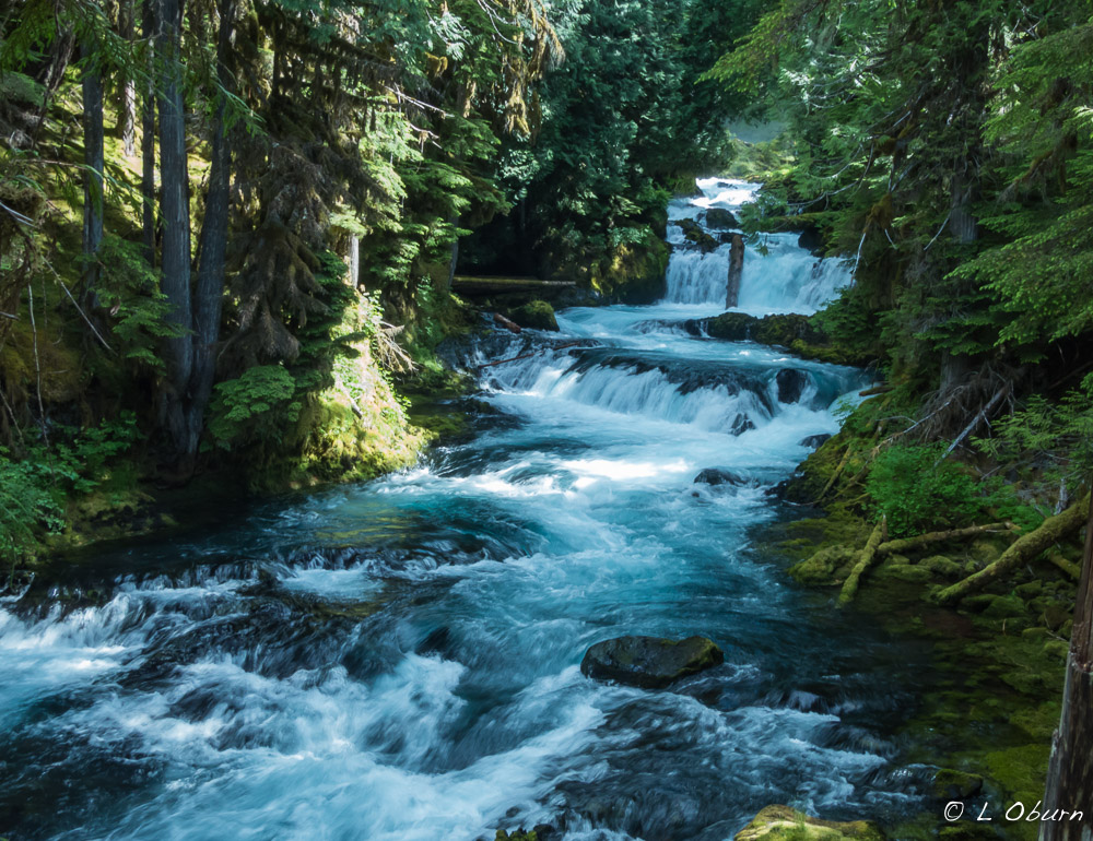
The initial phase of our drive took us to two beautiful “classic” Oregon Cascade waterfalls, via an easy 2.5-mile hike. The McKenzie River plunges over Sahalie Falls in an angry torrent, twists down a boulder-strewn canyon before once again throwing herself off the Koosah Falls cliff. Both falls are breathtaking and have been used in scenes for several movies.
We continued east onto Highway 242 and soon saw signs strongly advising against continuing over McKenzie Pass in vehicles longer than 35 feet. Terry hesitated, but being well within the limit we chose to carry on, and this is where things got rather interesting.
The road began to narrow, with several sharp turns, but before too long we arrived at our next stop, Proxy Falls. An easy 1.25-mile hike took us to the base of one of the most photographed spots in Oregon. This spectacular waterfall is nestled in a deep, heavily shadowed forest that seemed to evoke ancient myth. Many photos later we continued our slow crawl up the mountain.
The road leading up to McKenzie Pass continued to narrow, with no shoulders and hairpin turns so tight the road seemed to nearly fold back on itself in many places. Vertical rock formations edging the road added to the thrill. At one point a cyclist came flying down from the opposite direction, barely missing our bumper. If that wasn’t exciting enough (and it was), moments later a skateboarder, sans helmet, propelled himself down and around a turn, with a car right on his backside. Did I mention there are few guard rails on this road?
You can imagine our relief when we saw the sign for the pass, our final planned stop. On this windswept site sits Dee Wright Observatory, which offers a sweeping panorama of the Cascades and the lava flows that dominate the pass.
The remaining drive back to Sisters was uneventful. Needless to say, our second hiking choice along Highway 242, Black Crater, was crossed off the list as well. Scenic or not, we would not be venturing up that road again.
When we settled into our campsite, Terry pulled out his Mountain Directory book to read their interpretation of McKenzie Pass. “The “highway” on the west side of this pass is so narrow that in many places a regular-sized vehicle, such as a pickup or van, will be over the center line….A small motorhome might make it over this pass, but there is risk of damage”. This stretch of highway was aptly named Deadhorse Grade.

The hike we finally chose was more sedate than our drive, but no less thrilling, the Tam McArthur Rim trail. This 5-5-mile out-and-back hike, with 2400’ elevation gain, provided lovely views of Three Creek Lake and ended at the base of Broken Top Mountain. The vistas at the top were magnificent.
Our Sisters’ visit, like many, seemed far too short. We would love to stop back in the fall sometime for the nationally renowned Folk Festival. We hear it is an event not to be missed.

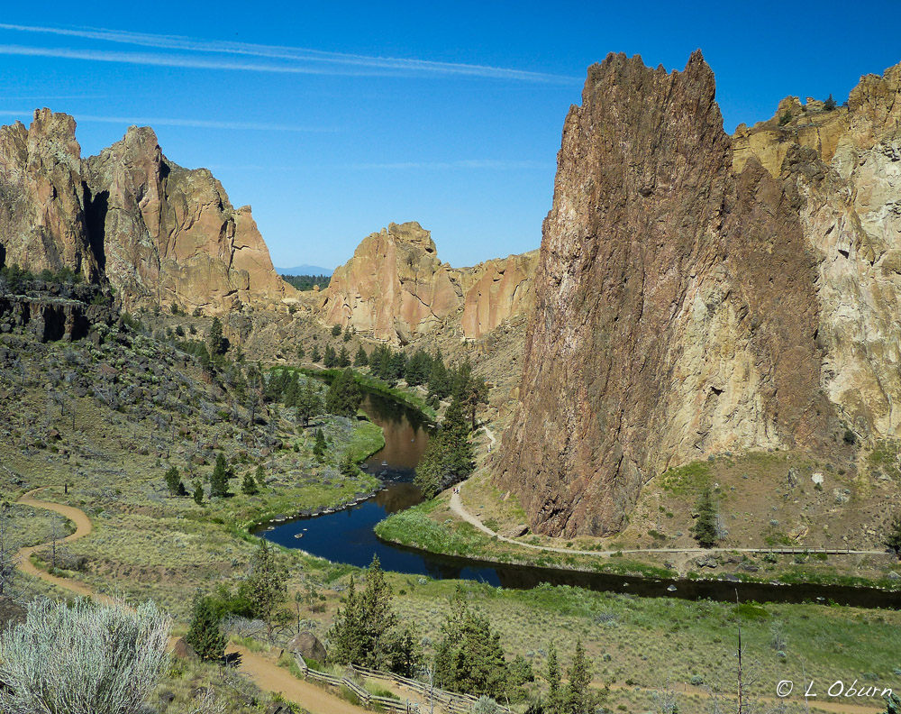 In Oregon’s high desert, near Terrebonne, striking spires rise up from the Crooked River Canyon. Crafted from molten rock and subsequent flowing water, these basalt tufts have been sculpted into what is now known as Smith Rock State Park. This striking setting draws cyclists, hikers, and photographers, and in the mid-1980’s gained the attention of rock climbers, both local and international. Today more than 1,000 bolted climbing routes dot the vertical basalt walls, challenging beginners and experts alike.