Of Fire and Ice ~ Lassen Volcanic National Park

Advice from a Volcano: “Stay active; keep your inner fire burning; it’s ok to let off steam; go with the flow; be uplifting; it’s all a matter of time; have a blast!” ~ Ilan Shamir

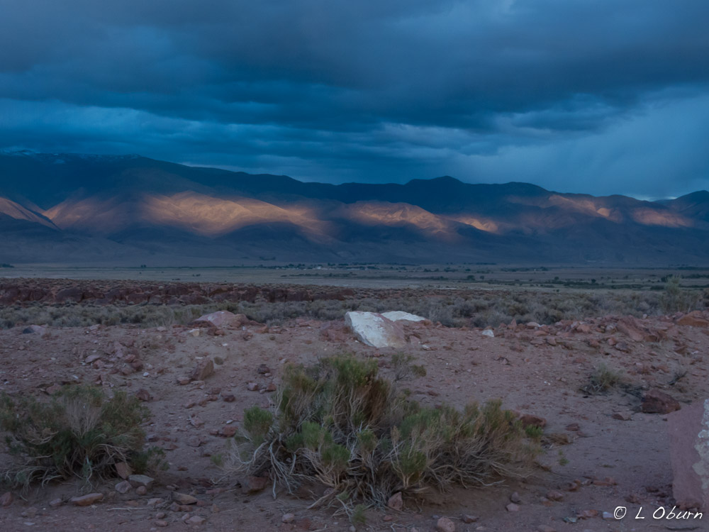
After living in Yellowstone National Park for two years, I became fascinated with the powerful forces of nature at work below the Earth’s surface, so it was not surprising that I was drawn to the “lava-strewn” landscape of Lassen Volcanic National Park.

Lassen Peak with Manzanita Lake in the foreground

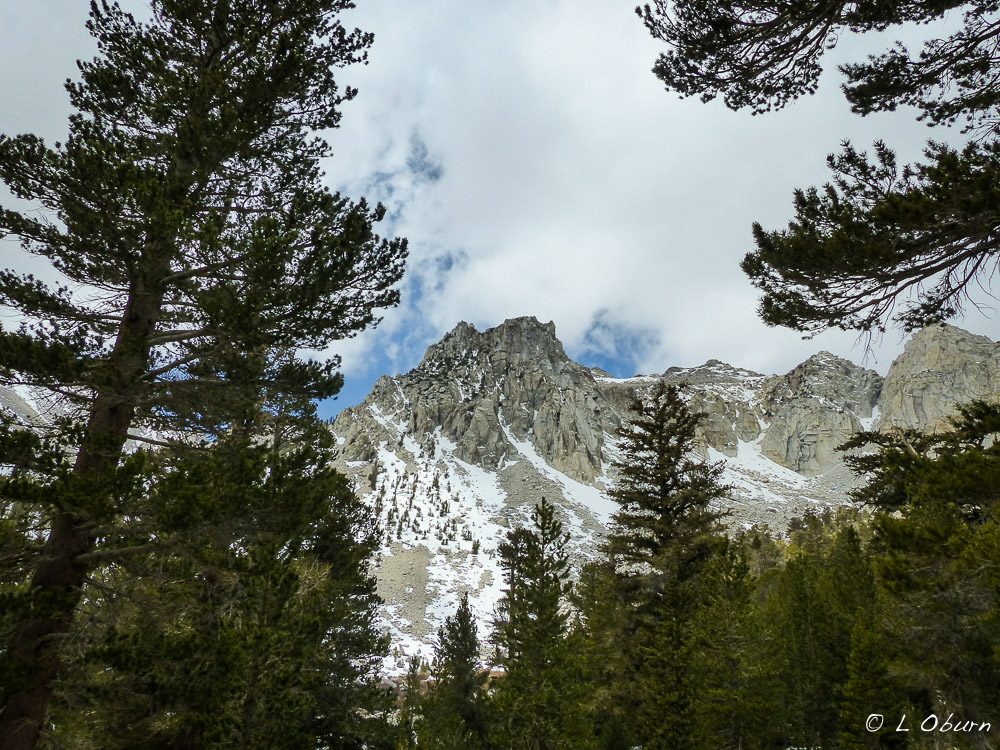
All rocks found in this park originated from volcanoes and all four types of volcanoes can be found here: shield, cinder cone, composite, and plug dome.   The main peak in the park is 10,463’ Lassen Peak, a plug dome volcano, formed when lava is too thick to flow a great distance so rises directly over the vent to form a dome.   She is a beauty and can be seen from many vantage points throughout the park.

May 22, 2015 marked the centennial of the Lassen Peak eruption, a cataclysmic event that blew a cloud of ash almost six miles into the atmosphere. Volcanic ash rained down over 200 miles to the east and boulders weighing as much as 300 tons were carried five miles from the peak. This explosion set the stage for establishing Lassen Volcanic National Park in August 1916.

Seismologists continue to study volcanic activity within the park. Earthscope, a plate boundary observatory station, is part of a network of over 875 stations installed across the western U.S. to study movement of the Earth’s crust.

Lassen Peak viewed from Devastated Area

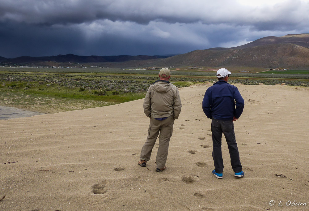
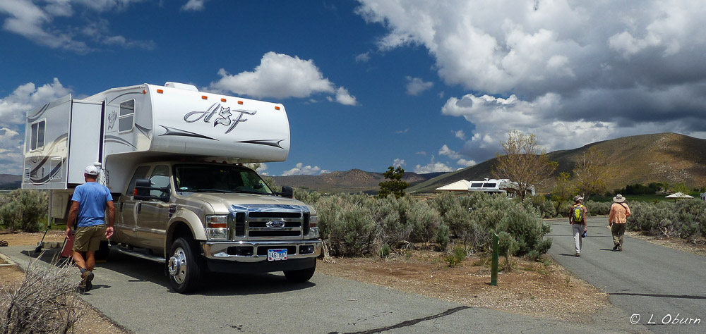
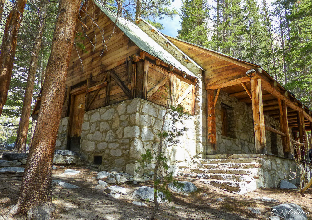
We stayed at Manzanita Lake in the northwestern part of the park, the only open campground when we arrived on Memorial Day. Lassen is one of the lesser-visited National Parks, possibly because it is a bit “off the beaten path”. With so much beauty and so much to offer, we found ourselves wishing for more time. A return trip is in order, as we felt we had only scratched the surface in 4 days.

Here is what we were able to squeeze into our short visit:

1) Manzanita Lake Trail – a tranquil 2-mile trail that is a must at sunset. Go at various times of the day and you will find something new at each visit.

2) Manzanita Creek Trail – a 7-mile obstacle course of fallen logs across the trail, caused by a severe windstorm earlier in the year. This was a ranger recommendation but the only positive for us was that it could be done from the campground.

Manzanita Creek Trail strewn with downed trees

3) Summit Lake Trail – The entire trail is an ~ 11-mile loop, with lots of crystal blue lakes. We did 7.5 miles to Lower Twin Lake, which brought us past four of them. We would have liked to complete the entire loop but Terry had taken a nasty fall a few nights before and did a fine job bruising his ribs. It seems climbing over downed logs on the trail wasn’t helping them much. 😉 Needless to say I had to hike on my own for the rest of our stay in Lassen.

Summit Lake
Summit Lake

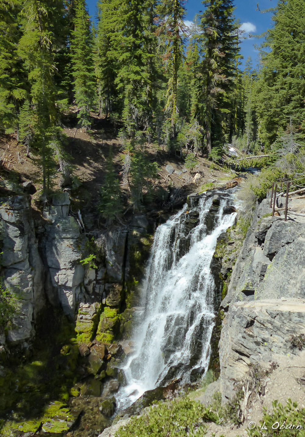
4) Kings Creek Falls Trail – a 3-mile trail down to a large waterfall. The foot trail was closed due to poor trail conditions so partway into the hike you were diverted to the horse trail, a steep rocky descent down to the falls. This hike had great views of Lassen Peak and the falls were quite lovely.

Kings Creek Falls
Kings Creek Falls

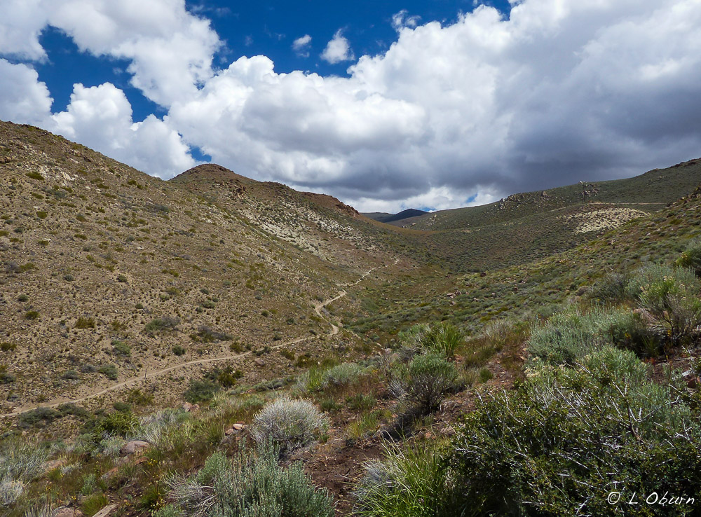
5) Road Trip – We drove the winding 30-mile main park road from north to south…gorgeous!

A few items on our list that will have to wait for another visit:

  •  Lassen Peak Trail – closed due to snow
  • Bumpass Hell Trail – closed due to snow
  • Cinder Cone – a hike to the top of a dormant volcano
  • Devil’s Kitchen – lots of geothermal activity in this area
  • Mills Creek Falls – tallest waterfall in the park
  • 185-mile scenic drive beginning in the town of Chester, meandering through forests, geothermal springs, craggy peaks, and lava fields of Lassen National Forest and Lassen Volcanic National Park.

Lassen Volcanic National Park has a quiet calm to it when you gaze upon its stately pines, jagged peaks still swaddled in deep blankets of snow, and crystal lakes. Yet far below the surface a fire still burns, evidenced by the hissing steam vents, bubbling mudpots and boiling springs dotting the landscape, symbols of nature’s powerful forces and diverse beauty.

A Vanishing Act ~ Washoe Lake State Park, NV

It seemed that we were finally leaving behind the cold, wintry weather of the Eastern Sierras as we continued our journey, but unfortunately not the rain. As we pulled into Washoe Lake State Park, with raindrops falling, at least the weather did not chill us to the bone, and we had two fair-sized cities within reach for restocking supplies, Carson City and Reno.

Something that did warm us even before heading to Washoe was receiving an email from a couple we had recently met, letting us know where they were headed, and saying “but you are probably many days behind us”. My reply, “just one day”, and before we knew it we were reconnecting with Life’s Little Adventures Jim and Gayle at the park. Seems we had both decided that Washoe was a quiet destination for avoiding the crowds over the Memorial Day weekend.

Jim & Terry watching yet another storm roll in before dashing back to the campground

During our last visit Washoe Lake was a mere shadow of itself, but this time it had managed a complete vanishing act, bone-dry due to the drought conditions in the west. Its reliance on snowpack and its normal 12’ depth has rendered it dry several times since the ‘70’s. Someday I would love to see it as an actual body of water, with pelicans bobbing on the surface and herons feeding on the shoreline.

Dry Washoe Lake today
Washoe Lake in its heyday, photo credit wunderground.com

Even without a drop of lake water, we still feel this is a great little find. The Carson and Virginia Mountain Ranges surround the campground, making for dramatic photos of mountaintops crowned with billowy clouds. Taking a walk through the desert right outside your door will reward you with sand dunes to explore, jackrabbits to watch racing across the sage-dotted landscape, and quail scurrying through the brush. Your cozy site will be large, level, and well paved, each with its own cabana, table, and fire ring.

The hillside trail where we finally managed a hike .
The hillside trail where we finally managed a hike
.

After three days of rain, with some short breaks for walks through the park, only to dash back to the warmth of our rigs when the rain fell again, the four of us finally awoke to a sunny day filled with birdsong. We quickly decided that a hike in the surrounding hills was in order to rid ourselves of the cabin fever that had cast its spell over us.

L-R:  Terry, Jim & Gayle clowning around
L-R: Terry, Jim & Gayle clowning around

Nights were reserved for getting to know each other better and for our ongoing lessons in craft brews from two of the “beer sommeliers” we had originally met at Jojoba Hills.

Heading home after a successful day of hiking

I felt a bit heavy-hearted as we left Washoe Lake State Park, sad to be saying goodbye to a couple who we knew that we wanted to get to know better. Before we left we were already contemplating our next rendezvous, such is the beauty of this lifestyle. And Jim sent us off with a list of craft beers that awaited us at the wine store in Reno. 🙂

Hauntingly Beautiful Mono Lake

One of the oldest lakes in North America, at least 760,000 years old, can be seen along Hwy 395 at Lee Vining, near the eastern border of Yosemite National Park. It is the enchanting, mysterious Mono Lake, one of the most productive lakes in the world.  Mark Twain dubbed this lake the “Dead Sea of California”, but he could not have been more wrong.  Not too many species can survive in this harsh environment but those that have adapted do so in prolific numbers.

Fed by five streams, underground seeps, and the Sierra snowpack, Mono Lake has no outlet.  Because of its inability to release water, it is three times saltier than the Pacific Ocean, an extremely alkaline condition.

If you were to swim in Mono Lake, and you can, you would be so buoyant you would bob up and down like a cork in water. As a comparison, below is the saline count of a couple of well-known bodies of water:

  • Lake Tahoe – 0.001% salt
  • Pacific Ocean – 3.5% salt
  • Mono Lake – 10% salt

To convert Lake Tahoe’s waters to that of Mono Lake, you would need to add the following to one quart of water:

  • 2.5 tablespoons table salt
  • 1.5 tablespoons baking soda
  • 2 tablespoons Epsom salts
  • a pinch of borax
  • a pinch of detergent

Is it any wonder that fish cannot survive in these waters? It is amazing to me that anything can. However, brine shrimp and alkali flies seem to like these salty waters just fine.

During the early spring months, the lake is “as green as pea soup”, due to the microscopic algae bloom.   As the water warms, recently hatched brine shrimp and alkali flies feed on the algae. By summer they have consumed so much algae that the lake water becomes clear and returns to a blue color once again.

Mono Lake_150520-1200634

In the warm summer months, an estimate of 4-6 trillion brine shrimp swim in these waters. Alkali flies live along the shore and walk underwater, encased in small air bubbles for grazing and to lay their eggs. These two Mono Lake inhabitants are an important source of food for the millions of migratory and nesting birds who find their way to this salty sea.

Mono Lake_150520-1200681

Interesting chemical reactions occur when freshwater springs (calcium) meet alkaline water (carbonates).  Calcium carbonate (solid limestone) is the result, better known to geologists as a tufa. These hauntingly beautiful formations have their beginnings underwater and continue to grow as freshwater and lake water meet. There is evidence of Ice Age tufa at Mono Lake, which grew beneath the water nearly 13,000 years ago. They have a crystalline structure that differs from more recent tufa. Mono Lake’s “petrified springs” are a fascinating example of what nature can do with a few basic ingredients.

Many photographers come to the South Tufa to capture these unique limestone statues. The best time for photos is at sunrise, if the sun makes an appearance, and she has been a bit timid these past several days.

At its height, Mono Lake soared to a depth of 900 feet, but now its average depth is a mere 50 feet, with a maximum depth of 150 feet.   The lake is currently seven vertical feel lower than its targeted level. About 45” of water is lost annually to evaporation, so freshwater inflow is critical to its health. Although we have been less than enchanted with the rain, sleet, and snow flurries that have pelted this area during our visit, we are comforted knowing that Mono Lake is the better for it.

We begin our journey north in search for warmer temps, as we can’t seem to will the thermometer to move beyond the 50 degree mark yet.

Small Town with a Big Back Yard and New Friends ~ Bishop, CA

Bishop, largest populated city in Inyo County, sits at the crossroads of well-known Highway 395 and Highway 6.  It has a small town feel as you walk its streets, meandering among long-time locals, hippies with dreadlocks and weathered backpackers.   With all Bishop has to offer, it may well be the most popular stopping off point along the Highway 395 corridor.

When I think of Bishop, this is the scene I first envision.

We had planned several days in Bishop before we headed out for the summer as we wanted to experience this bustling little jewel in the spring, but our stay has been longer than anticipated as Mother Nature has decided she is not yet done with winter in the Sierras. So what is there to do in Bishop when you are waiting out storm fronts? Here are our top 3 picks:

1) Feasting

Bishop is the foodie paradise on the 395, with over 40 restaurants covering any type of meal a discerning palette could want.   We followed Nina’s lead on this one.

Any guesses whether we ate the whole thing?

Bishop Burger Barn – offering a wide choice of burgers on homemade buns (even gluten-free) and grass-fed beef, the barn is a must if you love a good burger. Be forewarned, you could blow your daily allowance of calories in one sitting. We opted to bike out to the barn and felt just a wee bit comforted by the fact that we burned off a few extra calories, but definitely not as many as we consumed.

Mountain Rambler Brewery – new to town, with four of their own brews, one being a porter…yeah!  They are working on eight more taps and will surely improve over time.

Terry, Tom, & Z at Mountain Rambler Brewery

The best part of our time at the brewery was meeting new full-timers Zsuzsa (better known as Z) and Tom. Z is from Hungary and they are a delightful couple. We learned during our visit that it was their 5th-wheel that was parked next to Dragon Face Rock in the Alabama Hills when I was respectfully trying to capture a photo without encroaching on their campsite.   Facebook brought us together from there.

Great Basin Bakery – go for the cookies, especially the Sierra Mud and Molasses…amazing!

Thai Thai Restaurant – another meet-up with Z and Tom. We had eaten here during our last visit…tasty!

One last meal with Z & Tom before we leave Bishop.

2) Window Shop or Contribute to the Bishop Economy

There are lots of little boutique shops in which to spend your hard-earned money.  Here were our top three favorites.

Mountain Light Gallery – If you are the least bit interested in landscape photography, you should not miss out on the opportunity to visit this fabulous gallery, a tribute to the magical, one-of-a-kind photography of Galen Rowell and his wife Barbara.  We spent hours here during our last Bishop visit and did so again this time.

Wilson’s Eastside Sports – fabulous products, wonderful clerks and Terry is the proud owner of new hiking boots.

Spellbinder Books – a quaint bookstore with a variety of new and used books.

3) Hiking, Bouldering, Rock Climbing (now we’re talkin’)

There are plenty of high elevation hikes to consider but since the winter storms keep rolling in, this has been out of the question. It has made for some beautiful mountain photos but is not conducive to hiking. We did get our high altitude fix in when we last visited in the fall, which you can read about here.

Bishop, unbeknownst to us, is one of the top rock climbing places in the world, offering over 2,000 bouldering “problems” for all climbing levels.

Gigantic granite egg-shaped boulders dot the landscape in the Buttermilks, challenging the very best climbers.   It is said that the open windswept nature of these mountains will freeze your skin before your muscles give out.   The vistas are breathtaking, the hiking wonderful, and we were greeted by some interesting characters on the way back to our camper.

In the Volcanic Tablelands, where we spent several days boondocking, the volcanic tuff of the Happy and Sad Boulders present countless bouldering opportunities. The “Happies” have a larger choice of boulders and the “Sads”, less visited, have a dense population of more difficult problems. We visited both and the rock formations were spectacular. We hiked from where we camped and took the long way home, making for a 7-mile day of hiking and bouldering…fun times.

As of this writing we are still in Bishop, hoping for a break in the weather further north. It looks like spring here, with temps hovering near 70 degrees but the snow-capped mountains all around us tell another tale of what to expect on the mountain passes.  If we stay here much longer, we might get to experience Mule DaysBishop’s week-long festival held since 1969 celebrating the contributions pack mules have made to the area.  It might be fun to see but fingers-crossed we will be heading north soon.

Blue hour in the Volcanic Tablelands before the storm

Trekking on Hallowed Ground ~ John Muir Wildnerness

“Another glorious Sierra day in which one seems to be dissolved and absorbed and sent pulsing onward we know not where.  Life seems neither long nor short, and we take no more heed to save time or make haste than do the trees and stars.  This is true freedom, a good practical sort of immortality.”  ~  John Muir 

Some of the finest alpine hiking in this county can be found in the Sierra Nevada Mountain range.  Looking up at the peaks I am drawn to discover her secrets whispered on the wind; smell her intoxicating scents of pine and sage; listen to the thundering of crystal clear streams cascading down her slopes; walk on these hallowed grounds named in honor of the father of American environmental consciousness, naturalist John Muir.  To immerse yourself in these many wonders means your mind and body must embrace high altitude hiking, something in the past that has been a little challenging for me.  But my desire to embrace all this wilderness has to offer surpasses my concerns.

We were planning on two hikes while in the Independence and Big Pine areas, but the forecast wasn’t looking good, with snowstorms predicted in the mountains and rain in the valley.  We decided to camp outside Independence, up at the 6000′ level and get an early start on a hike that began at Onion Valley, the Kearsarge Pass Trail.  We arrived at the trailhead the next morning to a chilly 38º at an elevation of 9200′.  We layered-up and hit the trail.  Unless you have hiked in the mountains, you cannot imagine how breathtaking the alpine lakes can be and there were five that we encountered on our way up to the pass, some still frozen over, awaiting the spring thaw.

Once we cleared the tree line, the howling wind was our lone companion on the barren, windswept trail that switchbacked the remaining 1.5 miles to the pass. Snowflakes swirled around us as we continued our upward trek, but quite frankly, I did not notice their beauty until I stepped onto the pass.  The view down into Kings Canyon National Park, dotted with alpine lakes, was breathtaking.  And the sign indicating that we had arrived at an altitude of 11,760′ put a smile on my face that seemed frozen in place until we began our descent.  Snowflakes danced around us as if to the pulse of Nature’s heartbeat.

Our hike back down seemed colder than earlier in the day, as the winds picked up speed, bringing in a storm that would dump a foot of fresh snow in the mountains that night.  It was a beautiful 10-mile hike, albeit a bit frigid.

We sat out the storm and luckily the days following were warm, so after checking with the rangers and a couple of locals we decided to head out to Big Pine to hike the North Fork Trail.  Originally we thought we would hike to Black Lake to get a view of the Palisade Glacier, the largest in the Sierras and the southernmost in the U.S.  When we came to the fork in the road, we opted for Third Lake, which is fed by the glacier, and was reported to be a milky turquoise color. The hike was the same distance and the lure of several more alpine lakes was too much to pass by.

This hike begins at 7700′ and unlike the many switchbacks on the Kearsarge Pass Trail, it has a grueling long stretch of upward climbing.  You can almost forget about how tiring this first section is by looking at the beauty around you. You catch a glimpse of the Middle Palisade Glacier on this stretch, and some lovely waterfalls.  Once beyond the uphill slog the trail begins to zigzag through a slope of sagebrush, manzanita, and Jeffrey pine, before reaching Second Falls.  And once again you are bewitched by the tantalizing smells and sounds enveloping you.

At the 3-mile mark you come upon a cabin built by movie actor Lon Chaney, now used as a wilderness ranger camp, a beautiful setting along a lovely stream.

Lon Chaney cabin
Lon Chaney cabin

Continue upward and you arrive at First Lake, a lovely blue-green oasis sitting in a bowl, then on to Second Lake a short distance later.

First Lake
First Lake
Second Lake
Second Lake
Third Lake with Temple Crag looming overhead

Third Lake, where we planned to stop and have lunch, was a bit of a disappointment, but still a handsome gal with Tempe Crag looming over her.   Given the lack of snowfall these past four years, glacial runoff has not been occurring at the normal rate so her coloring was, shall we say, less than spectacular.  It was still “lunch with a view” as John and Pam would say, and at 10,400′, the air was crisp and the sun was shining.  Once we lightened our load by consuming a few calories we headed back down the trail, making for an exhilarating, but bone-weary 11-mile trek.

There is another storm predicted but we are hopeful to do a few more hikes before we leave the Sierras.  To quote John Muir, there is nothing like hiking in the mountains to “wash your spirit clean”.

Next Stop:  Bishop, CA