Bringing the Past to Life

We have settled into our “summer home” on the outskirts of our nation’s capitol. Volunteering as camp hosts at Greenbelt Park, a park under the auspices of the National Park Service, it is our small way of giving back, as we know many of our national parks are at risk without the help of volunteers, and it also puts us in the middle of a metropolitan area that begs to be explored.  Our biggest challenge this summer will be remaining tick-free. 😦

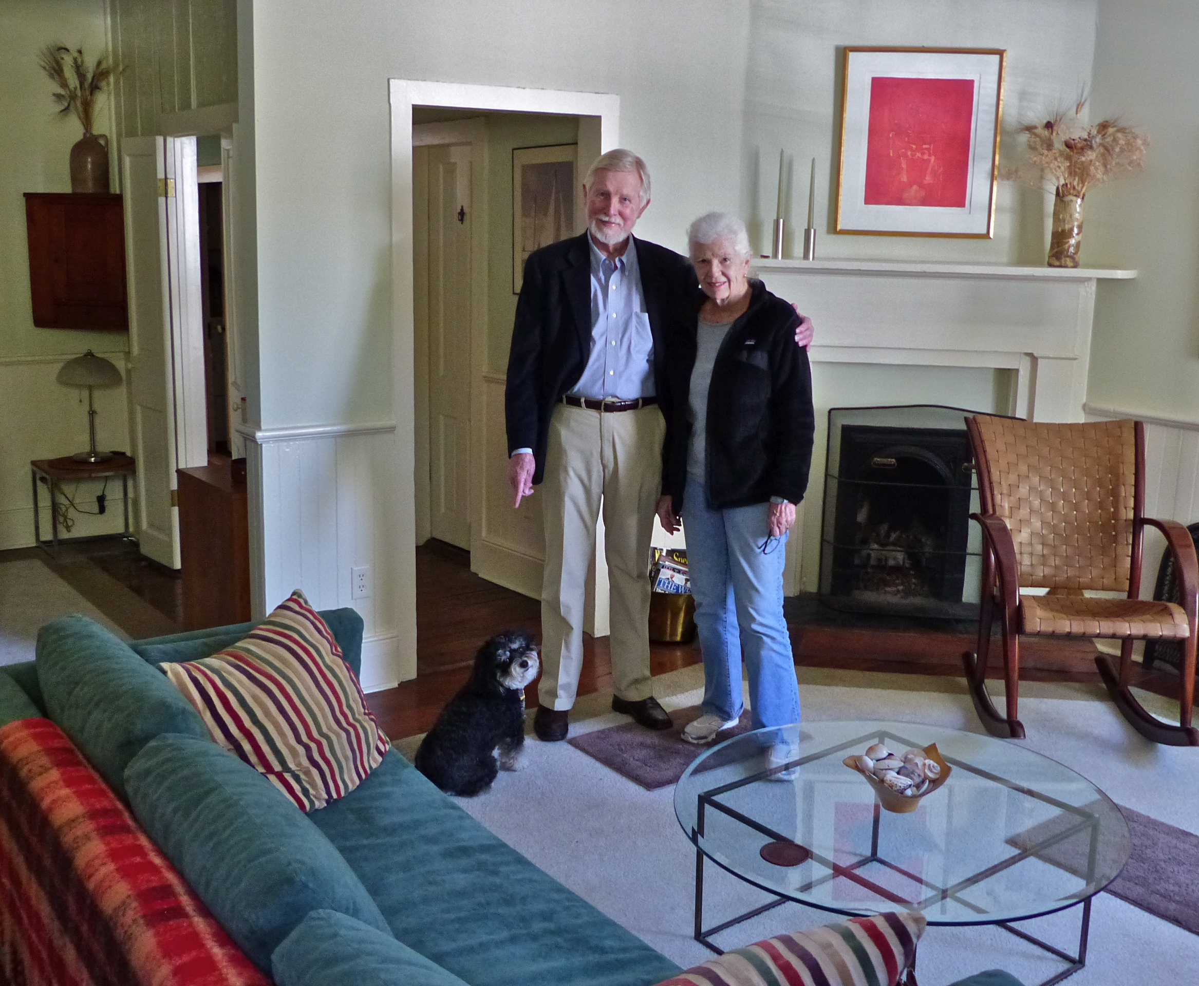
Our new-found friends John and Pam, of “Oh, the Places They Go” were headed in the same direction up the east coast as we and they offered to play tour guide in DC…perfect!  What began as the seeds of a grand biking adventure resulted in two days of horrendous rainstorms and flood warnings around the area.  What appeared to be a “wash-out” ended in a day spent getting to know each other better over coffee, and continuing over lunch.  Although our original plans had been washed away, we walked away feeling once again as if we had rekindled an old friendship instead of shaping a new one.

Fast forward several days and we find ourselves headed to a place that had a resounding impact on our nation, Gettysburg, PA, once again looking forward to our guide John giving us a tour of one of the bloodiest skirmishes of the American Civil War, the Battle of Gettysburg.  Lest you think I am going to bore you with facts and figures, fear not.  I would not attempt to claim much retention of elementary-school knowledge of the Battle of Gettysburg beyond the most rudimentary information.  This post is meant to speak to the generosity of a couple and the passion clearly felt in the stories John shared with us, a man who clearly has a love for the history of this wonderful country.  He brought the landscape alive for us, bringing the past into the present.  His eyes danced as he shared stories at various stops along the battlefield grounds.

I must admit that as we approached the town of Gettysburg, I felt a hush descend over the landscape as I looked out over the myriad statues, monuments, and markers dotting the countryside, symbolizing the events that felled so many those three days. Since this day was all about our nation’s history, please allow me to throw out a few facts, to bring the full import of Gettysburg to light and to let John know that the hours of sharing his love of history were not spent in vain. 😉

For those who may not remember, the Battle of Gettysburg, fought between Union and Confederate soldiers during the Civil Way, continued over a three-day period, from July 1-July 3, 1863.  After the fighting ended, it would be known as the battle carrying the largest number of casualties of the entire war, estimates ranging from 46,000 to 51,000 on both sides.  Although the Civil War continued for another two years after this fight ended, the Battle of Gettysburg is often described as the “turning point of the war”.  Given that this battle took place in the streets of Gettysburg and surrounding hillsides, it is rather remarkable that there is only one documented civilian casualty, Ginnie Wade, a 20-year old hit by a stray bullet while making bread in her kitchen. Bullet-riddled brick walls can still be seen today outside the Farnsworth House restaurant in town, where we lunched.

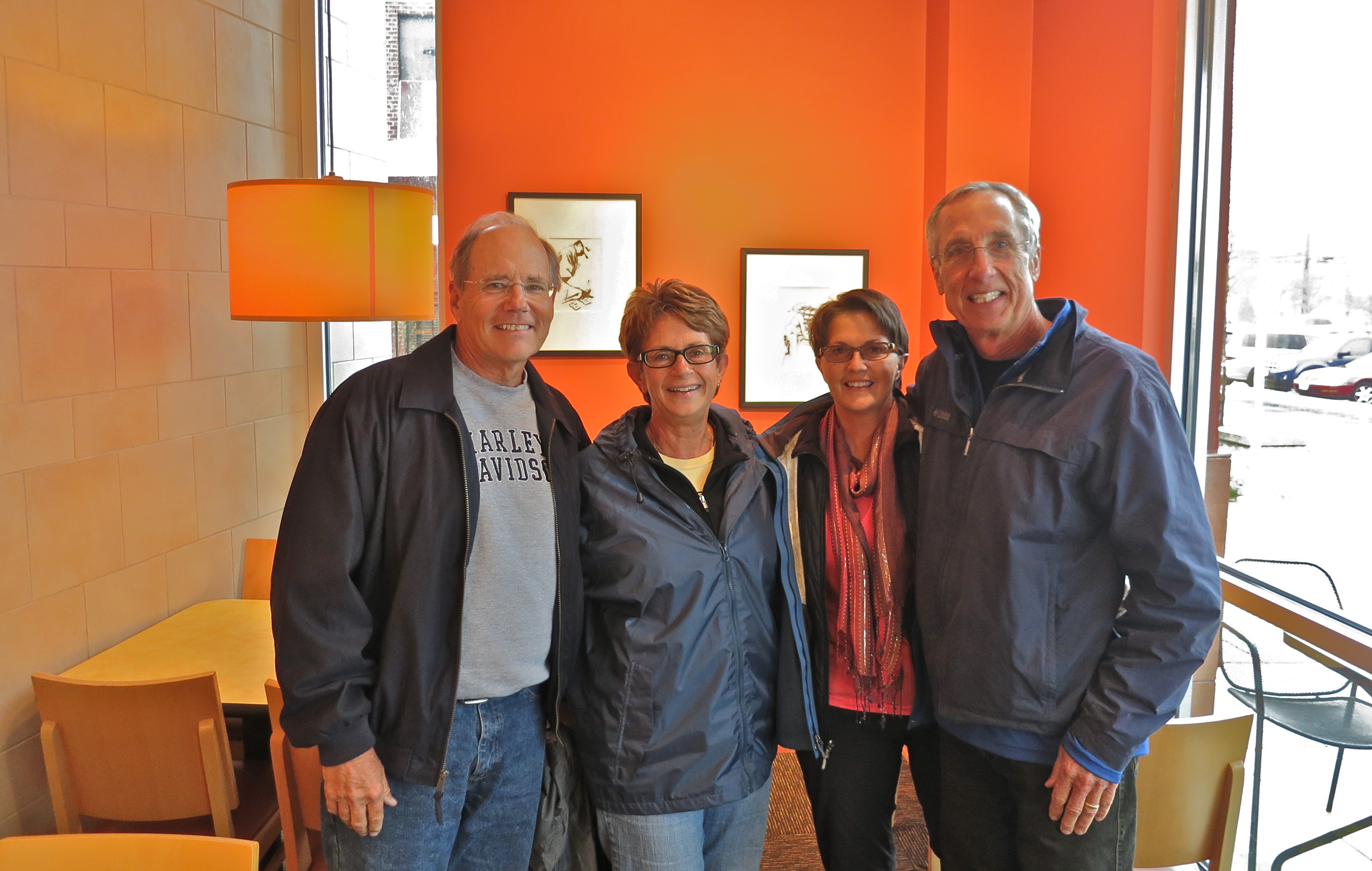
Not unlike our last meeting with John and Pam, rain and grey skies followed us, although not even the weather could put a damper on the day.  We parted with the hope of beautiful hikes together out west later this year.  Given the drought conditions in the southwest, certainly with our track record we could bring some much-needed precipitation to the area! 🙂

We can’t thank you enough John and Pam for the incredible day.  Your generosity will not be forgotten and we will come back for more before we leave DC.

Lightkeepers of the Outer Banks

Unfortunately most of our time spent in the Outer Banks was a bust weather-wise, bringing blustery winds and cold rains.  Planned bike rides and walks on the beach were scrapped most days, so instead we turned our attention to visiting the lightkeepers of the Outer Banksthose lone sentinels with piercing gaze, standing guard over the dangerous channels and shoals, always at the ready to guide mariners to safety.

The entire stretch of coastline along the Outer Banks has been nicknamed the “Graveyard of the Atlantic”, given the 1000+ ships that have succumbed to a watery grave here since record keeping began in 1526.  The cold waters of the Labrador Current crash into the warmer waters of the Gulf Stream, resulting in severe weather, strong currents and thick fog.

We visited five towering lighthouses along the coastline, although many would say only four actually stand within the Outer Banks’ boundaries.  The southernmost light station at Cape Lookout resides in the Core Banks, immediately south of the Outer Banks, although there is much discussion about exactly where the Outer Banks begin and end.  Regardless, we found each of these stately brick lighthouses to be fascinating, each with their own unique designs and light patterns to act as location markers for seagoing vessels.

1)  Currituck Beach Lighthouse

Currituck Beach Lighthouse is the northernmost lighthouse, in Corolla, NC.  Prior to constructing this light station, there was an 80-mile navigational void along this stretch of land where many vessels languished.  Standing 158 feet tall, this unusual unpainted brick beacon began flashing its 1st-order Fresnel lens on December 1, 1875.  Its light rotates in 20 second increments and can be seen 18 miles out to sea.  The lighthouse’s 220 steps are  open to the public for climbing, giving a wonderful panoramic view of the Currituck Sound and the Atlantic Ocean.

2)  Bodie Island Lighthouse

Bodie Island Lighthouse (pronounced ‘body’) stands just south of Nags Head and is the third beacon built along this stretch of coastline.  The first was abandoned due to a poor foundation and the second obliterated by Confederate troops.  The present-day structure was completed in 1872 and stands in an atypical setting of tall pines and marshland.  Standing 150 feet tall, it is said to be the architectural twin of Currituck Beach, but is not open to the public for climbing.  Bodie carries the familiar black and white horizontal stripes common to many lighthouses, casting its 1st-order Fresnel lens 19 miles over the ocean.

3)  Cape Hatteras Lighthouse

Known as “America’s Lighthouse”, Cape Hatteras is the tallest brick lighthouse in the country, standing 208 feet tall.  Its familiar black and white spiral-striped tower guards one of the most dangerous stretches of the Outer Banks, 12 miles of shifting sandbars sitting off Cape Hatteras, known as the Diamond Shoals.  The present-day beacon was completed in December 1870 and today uses two 1000-watt lamps to guide mariners, throwing its light 20 miles out to sea.

In 1999 the Cape Hatteras Lighthouse was moved inland one-half mile to save it from the ravages of the intruding Atlantic.  It was cut from its base, lifted onto steel beams and transported via railroad tracks to its current location.  The interior 269 steps are open to the public; however, we determined its beauty was best seen from afar as we watched a large bus full of pre-teens standing in line to tackle the climb. 😉

4)  Ocracoke Lighthouse

Ocracoke Lighthouse is North Carolina’s oldest operating lighthouse.  The present-day structure, built in 1822, is the third, with the first two being replaced due to shifting inlet sands.  Standing 75 feet tall, it shines its constant fixed beam 14 miles out to sea.  It is not open to the public for climbing and if you want to see her, you must access the free ferry over to Ocracoke Island.  Fair warning, be prepared to wait in long lines to get onto the ferry.  We waited 2 1/2 hours and peak season was not yet upon us.

5)  Cape Lookout Lighthouse

Cape Lookout Lighthouse, whose structure is very similar to that of Bodie and Currituck, stands 163 feet in height, with 207 interior spiraling steps that can be traversed during summer months.  Not unlike Ocracoke, it must be accessed by small ferry from Harker’s Island, and if you are lucky on the ride over, you may spot the wild ponies of Shackleford Banks.

As is true of most of the beacons in the Outer Banks, the present-day lighthouse is not the first.  The original structure was not tall enough to spot before many navigators ran into the Lookout Shoals, nicknamed the “Horrible Headland”.  Today’s beacon reaches 20 miles out to sea thanks to two 1000-watt electric bulbs.  An underwater cable running from Harker’s Island supplies electricity to the lighthouse.

What makes Cape Lookout truly unique is her black and white diamond pattern, unlike any other in the Outer Banks.  The black diamonds face north/south, while the white face east/west, a great daytime navigational aid.

Our time in the Outer Banks has ended and we now point our rig towards our nation’s capitol, specifically Greenbelt, MD, where we will be camp host volunteers for the summer at Greenbelt Park.

We look forward to new adventures and already know we have a treat waiting for us when we arrive.  More to come on that. 🙂

Wild Horses and a Chance Meeting ~ Cape Lookout National Seashore

“Wild, wild horses, couldn’t drag me away.  Wild, wild horses, we’ll ride them someday.”  ~ The Rolling Stones

Jutting out into the Atlantic, off the coast of North Carolina, runs a low, narrow ribbon of sand, dunes, seagrass, and dense vegetation known as the Outer Banks.  At the southernmost end of this strand of barrier islands sits Cape Lookout National Seashore, running 56 miles in length, and consisting of three barrier islands, Shackleford Banks, North Core Bank, and South Core Bank.

Shackleford Banks is nine miles in length and one mile across and is home to more than 110 wild horses, the Banker Horses.  Smaller in stature than other similar breeds, most likely due to the limited nutrients in their diet, many refer to them as the Banker Ponies.   Researchers believe the Bankers came over from Spain, via Hispaniola (located between Cuba and Puerto Rico) in the early 16th century.  We are on a quest for these wild beauties.

Hopping on a ferry to Shackleford, we were told not many horses had been seen recently but I was determined to see just one, that’s all I wanted.  Well ok, what I secretly desired watching an entire herd racing along the beach, sand and spray following in their wake.  A girl can dream, can’t she?

While others hopped off the ferry with beach gear in hand, we headed to the interior, hoping to find horses in a sheltered part of the island.  Cresting a sand dune an hour later, our search was over.  A band of eight grazed in the grassy meadow below us.  Not wanting to spook them, we sat down in the grass to watch, not the most intelligent decision we made that day, but more about that later.  These little beauties allowed us to share their space for 30 minutes…ahh, life is good.

What started as a beautiful day observing wild horses ended with Terry in Urgent Care a couple of days later, with a series of events in between that were just meant to happen (no coincidences here).

The next day found us scrambling to change our plans to take our RV, via ferry, to Ocracoke, thanks to a poorly constructed temporary bridge we happened to cross, one very rickety wooden, steeply pitched bridge that looked impossible to traverse without getting our home stuck.  And we had to cross this bridge to get to Cedar Island to pick up the ferry. 😦

Terry’s thoughtful decision to let the campground manager know about the bridge construction allowed us to meet a lovely couple from Maine the next afternoon, and a very lucky meeting it was to be.

Terry surprised me that morning by announcing he needed help ridding himself of not one, but three ticks, and guess where he most likely picked up these creepy little bacteria/disease ridden arachnids.  Yep, sitting in the grass at Shackleford.  Two of them were content to stop feasting on hubby but one was determined to stay.   Tweezers and some patience disrupted his plans but a part of me was still a bit nervous as we didn’t know how long they had been attached and they were teeny, tiny, not easy to identity.

Enter Richard and Sigrid, the lovely couple from Maine, who stopped by to discuss the bridge situation as this was also their planned route to Ocracoke. The conversation moved on to the subject of ticks, with them being quite knowledgeable, having spent their lives in Maine.  One look and they said “you need to have that looked at” and within the next few minutes we were headed to Urgent Care.

Yep, those tiny little ticks were what we had feared, deer ticks, potential carriers of Lyme disease, and they had been attached most likely in excess of 48 hours.  Before we had gotten to the doctor, a “halo” had formed around one of the bite areas.  A round of antibiotics and Terry should be good to go.  He was happy to surrender his halo, even though it would most likely be the only one he would ever have. 😉  Our many thanks to Richard and Sigrid who urged Terry towards the doctor, a place he, like so many, is reluctant to go.

We continue our exploration northward in the Outer Banks.  Brrr, what happened to spring?

Where the Past is Always Present ~ Charleston, SC

As we left Savannah heading for Charleston, my thought was that it might be a bit overwhelming to visit these two cities back-to-back, given their historical significance.  I did not have long to worry as the weather forecast made most of our plans for us.  A strong storm system was moving our way, bringing lots of rain and the potential for thunderstorms and a tornado watch.  And if that was not enough, we learned upon arrival that the Cooper River Bridge Run, one of the best attended 10k races in the country, bringing 40,000 runners plus family and friends to the city, was to take place the weekend we would be in Charleston.  This race shuts down part of the city, so decision made.   We would have a short window of time to explore so as soon as we finished setting up at the Oak Plantation Campground, we headed to historic downtown.

One of our first stops in many big cities, Charleston being no exception, is the Visitor Center to get the lay of the land and pick up a map.  We headed out on foot, our typical mode of travel, hitting some of the high points but in general just inhaling the city’s ambiance.  Known for its rich history, well-maintained architecture, and gracious residents (having received ‘America’s Most Friendly City’ award twice in the past three years), I felt the city still maintained its antebellum air.  I would not have been surprised if I rounded the corner to find men and women in period dress, ready to greet us.

Charleston, South Carolina’s oldest city, founded in 1670, is a much larger and sprawling city than Savannah so traversing her streets takes time, more time than we had.  It was evident this was to be a cursory review of a city that deserved much more attention.

With Charleston’s 100+ churches and the nickname of “Holy City”, what could we do but visit a few?

St. Philip’s Church, housing the oldest congregation in all of South Carolina, dates back to 1680.  Her stately steeple stands as a testament to her storied history and her interior stunning, most notably the Trompette en Chamade (Shouting Trumpets) that we were told take your breath away no matter how many times you hear them.  Old cemeteries on many of the church grounds have stories to tell, and St. Philip’s has a most prestigious tale, with this being the final resting place of Edward Rutledge, signer of the Declaration of Independence and Charles Pinckney, signer of the Constitution.  This is only one of many magnificent places to worship in the city.

Wile visiting Sullivan’s Island, across the bridge from Charleston, I was taking a few photos of what I thought was an interesting old church, when a young man walked up and asked if I would care to see the inside of what was once a church turned private residence.  After offering my apologies for intruding, I gestured to Terry to get out of the truck and follow me inside.  The inside was gorgeous and had a Gothic castle feel and the kitchen, oh my!  You can read the interesting story of this property here.

Is it a church?  Is it a castle?  Nope, just a very pricey private residence.
Is it a church? Is it a castle? Nope, just a very pricey private residence.

Churches, universities, and cemeteries seem to be our “thing” when visiting cities, so a trip to the Citadel, rain or shine, had to be one of our stops.  The ceremonial parade ground comes into view as you cross the gates, with impressive stark-white buildings lining it.  With their core values of “Honor, Duty, Respect”, there is an intimacy felt walking these hushed grounds, a special way to round out our Charleston experience.

Citadel graduates have fought in every American war since the Mexican-American War of 1846.  Alumni and author Pat Conroy wrote The Lords of Discipline, based on his time at the Citadel.

Sightseeing makes one ravenous and with so many fabulous-sounding restaurants to choose from, we settled on the Bull Street Gourmet and Market for lunch.  The smoked duck salad was soo yummy! 🙂  And on a rainy day, while watching Bizarre Foods America with Andrew Zimmern, to see just what he might put into his mouth masquerading as something edible, he featured a funky little soul food eatery in Charleston, Martha Lou’s Kitchen.  About as much time as it took us to say “let’s go”, we were out the door.  You will not find any low-cal food here, but you will find two women with a lot of spunk who are passionate about their southern comfort food.  The fried chicken and the pork chop were both so tasty and once again I ate my collard greens – delish!  The women who work here will sing and dance their way into your heart, and if you come during the week you will be graced with Martha Lou’s presence, still a force at age 84.

Here is just a sampling of the lovely sights you can see when visiting historic Charleston, a city where the past is always present:

We now look forward to some downtime, “beach-style” as we head to Murrell’s Inlet, SC.

Georgia’s Oldest Jewel ~ Savannah

We have settled into Skidaway Island State Park, a convenient location for exploring historic Savannah.  Large pull-thru sites beneath arching canopies of live oaks greet you as you enter the campground and  seven miles of trails wind through maritime forests, a relaxing place to spend a week.  Just beyond the borders of the park, on the island, lie 40 miles of biking/walking trails, meandering through genteel southern neighborhoods, through forests of oak and pine, and past salt marshes.  While we have spent most days “spinning our wheels”, we set aside plenty of time to wander the historic streets of Savannah.

Savannah’s history began in 1733 when British General James Oglethorpe founded the colony of Georgia as a place to resettle Britain’s poor who were housed in debtors’ prisons.  His design for Savannah was patterned after a contemporary military camp, a central square surrounded by eight city blocks, which formed a ward.  This concept grew until there were 24 squares and of those, 22 still exist today, making Georgia’s oldest city a jewel unlike any other in the US.

All the squares are part of the historic district, encompassing a one-half mile radius, each serving as memorials, with statues or fountains surrounded by lush foliage.   Historic churches and 18th and 19th architectural styling of every kind can be found in the blocks lining the squares, along with azaleas and dogwood adding a breathtaking lushness to the ambiance.  These squares are the heart and soul of Savannah.   The streets surrounding the squares allow for a continual flow of traffic, at a nice pace, making this a pedestrian-friendly city. We chose to spend our days walking it but there is a trolley service available as well, allowing tourists to hop on and off at their leisure.

During one of our many strolls through historic downtown, we found ourselves in Washington Square, where the oldest homes in Savannah can be found. A smartly dressed man, walking a lovely little dog, proceeded to introduce himself as Fred and invited us to take a tour of a lovely historic home that dated back to the late 1700’s, still featuring the original hand-hewn oak walls and hardwood floors.  This historic home was where Fred, his wife Susan, talented artist and author, and adorable rescue dog Lucy live.  Susan was gracious and let us intrude on her day, and we walked away with an autographed copy of her book, Spirit Willing.  

Fred, Susan, and the lovely Lucy

Few cities with such a colorful past would be complete without sightings of restless spirits wandering the cemeteries late at night and Savannah is no exception.  Colonial Cemetery, the oldest in the city, is said to be one of the most haunted places in Savannah, where Voodoo ceremonies once took place in the wee dark hours.  This is the final resting place for many of Savannah’s earliest citizens and a signer of the Declaration of Independence is also buried here.

Bonaventure Cemetery, Savannah’s most famous, thanks to being prominently featured in John Berendt’s best-seller Midnight in the Garden of Good and Evil, is also alleged to have ghostly sightings.  Bonaventure stands on the grounds of what was once a plantation.  Legend has it that the main house caught fire during a party and the host calmly suggested the guests pick up their crystal glasses and take them outside to continue the party.  As they watched fire consume the house, the partiers  smashed their empty crystal against an oak tree, and it is said that on quiet nights you can still hear the laughter and the shattering of crystal.

We can’t attest to roaming spirits, but the grounds where generals, poets, governors, and Academy award-winning lyricist Johnny Mercer lie in eternal rest are hauntingly beautiful.  Many elaborate crypts overlook the Wilmington River, with live oaks, azaleas, dogwood, and roses surrounding intricate headstones and life-size statues.

Since Savannah’s history is rooted in the American Revolution and Civil War eras, we decided a visit to Fort Pulaski National Monument was in order, a fort meant to guard the river approaches to the city.  We have seen many forts during our travels and I must admit to many holding little interest for me, but this one was  different.  Strategically built on Cockspur Island and named for Count Casimir Pulaski, Polish hero of the American Revolution, Fort Pulaski was thought to be impregnable.  However, during the Civil War a Confederate garrison was forced to surrender the fort when a Union army used rifled cannons during an attack (new military technology for that age), landing mortar dangerously close to the magazine storing 40,000 pounds of gunpowder.   The scarred wall of the fort remains today.

We were so impressed with Savannah’s quaint elegance, her azalea-lined cobble stone streets beneath emerald-green canopies, and her historied architecture.  Should you decide to visit, don’t leave without a stop at Leopold’s Ice Cream, ranked one of the top 10 in the world.  I leave you with a few other images of Savannah, as we say farewell to this fascinating city and move on to a sister city, Charleston, South Carolina.