Getting High with Friends ~ Longmont, CO

Did I get your attention?  Well, we are in Colorado, where an altered state of mind is perfectly legal these days.  However, the high I am referring to is the altitude, where a bit of acclimatizing is in order for us before getting too aggressive on the trails.

We have been looking forward to our Colorado trip for some months, where visiting friends, attending a niece’s wedding and hiking in the beautiful Rockies was on the agenda.  As can be expected at this time of year, Mother Nature has been fickle, unsure if she wanted to draw us into autumn or drag us back to the dog days of summer.  Within a few short days she chose to do both.

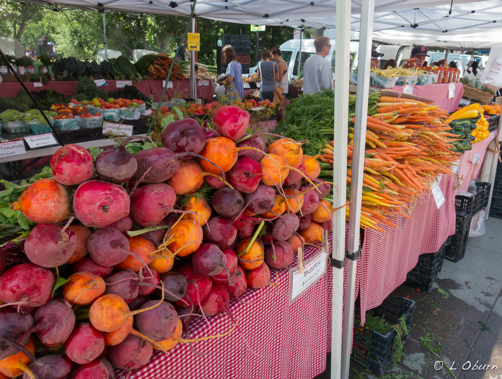
Our intended plans to hike these magnificent mountains with friends Stan and Marilyn didn’t materialize as storms moved through the Boulder area the first few days of our visit.  Not to be deterred, we settled for a farmers’ market visit, shopping, and some wonderful meals filled with lots of laughter and reminiscing.   Hopefully we will be able to squeeze in their recommended hike before we have to move on.

Delicious-looking vegetables at the Boulder Farmers' Market
Delicious-looking vegetables at the Boulder Farmers’ Market

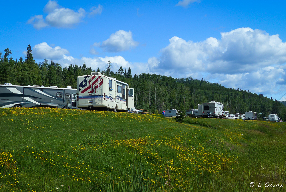
Knowing we were in the area, Ingrid and Al of Live Laugh RV decided to join us at St. Vrain State Park, a park we chose due to its proximity to Boulder and Rocky Mountain National Park.  Although we had only a couple of days in the park before we had to hop a plane back to Ohio to attend our father’s memorial service, we were able to catch up on each other’s travels over dinner at our place, with Ingrid providing some very tasty cookies for dessert.  A girl’s day of sightseeing and shopping rounded out our visit before we parted ways.  Sadly I did not pick up the camera during our time with either of these couples.   Sometimes reminiscing and a good meal takes precedence over photography.

The Chapel on the Rock at Camp St. Malo outside Allenspark, CO.

I had little time to explore St. Vrain and when I did, the birds that I often saw flying overhead, white pelicans, osprey, and Canada geese, were absent from the many ponds on the property.  To see some lovely images of these fine-feathered fowl, check out Ingrid’s post here.

Sunrise over St Vrain SP, with the snow-dusted Rockies in the background

After our whirlwind Ohio trip, exercise was foremost in our minds, so it was time to pull out the Rocky Mountain hiking maps. I had read quite a bit about the beauty of Wild Basin, both in our books and from Ingrid so we decided upon a hike to Ouzel Lake. Beginning at an altitude of ~8500 feet, with a 1500 foot elevation gain, it was a great acclimatizing hike.

Aspen and Ponderosa pine lined the trail and the sound of water crashing over boulders could be heard most of the way.  What we hadn’t anticipated was the bridge just below Ouzel Falls being out, due to the flooding in 2013.  Try as we might, climbing above and behind the falls did not provide a way to reconnect with the trail.

The rangers who were working to rebuild the bridge were discouraging anyone from attending to forge St. Vrain Creek, due to the heavy rains the previous few days.  After checking out a few potential crossing points, we decided to choose safety over daring. So what started as a 10-mile hike ended at 6.5 miles, not bad for a first hike in the Rockies.

We had time for one more hike in Rocky Mountain National Park before moving on so we settled on Timberline Falls.  Beginning at Bear Lake Trailhead and looping back around to Glacier Gorge Trailhead, this 10-mile hike takes you past beautiful alpine lakes and waterfalls, with breathtaking views of the Colorado peaks.

It begins at 9,100 feet, with an elevation gain of 1,560 feet, two-thirds of that being in the last mile before you reach Timberline Falls.

From Timberline you can scale a 30-foot mist-soaked vertical wall to continue to Sky Pond but seeing hikers coming back down backwards off this wall, we did not feel the need to go that extra quarter-mile.

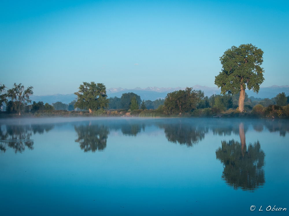
Following a brief storm, our final night at St. Vrain yielded a lovely sunset over the Colorado peaks.

Bizarre, Broken, Bewitching ~ Theodore Roosevelt National Park (Part 2)

“The Badlands grade all the way from those that are almost rolling in character to those that are so fantastically broken in form and so bizarre in color as to seem hardly properly to belong to this earth.”  ~ Theodore Roosevelt

Storm clouds build over the Little Missouri

The Badlands story, of which Theodore Roosevelt National Park is a part, began over 65 million years ago.  While the Rocky Mountains were rising from the earth, bucking and writhing to claim their place in the landscape, massive amounts of sediments were being carried east on the wind and in the water, creating this desolate mural.  Savagely erupting volcanoes in surrounding states were belching ash to combine with the Rocky Mountain sediments.  The badlands are the result of layers of sandstone, mudstone, siltstone, and bentonite clay air-brushed into unusual rock formations and vivid striated buttes.

This national park was once on the eastern edge of a swamp and over time these sediments compressed and broke down, causing chemical changes that resulted in the formation of lignite, a soft coal that Teddy Roosevelt shoveled into his stove to heat his home.  In these striated buttes, lignite can still be seen.  Lightning strikes and fires cause the lignite to smolder, which in many cases can continue underground for years. The hardened red-brick caps, known as “scoria”, seen on many rock formations, come from the oxidation of iron released from the burning of this coal.  The artistry of time, wind, and erosion have created the landscape we see today, which is constantly being transformed.

The 110 square miles of Theodore Roosevelt National Park cover three distinct areas of Badlands in western North Dakota and the Little Missouri River snakes through all of them.

  • The larger South Unit within the town of Medora, where we are camped
  • The smaller North Unit, ~80 miles north of the South Unit, off Hwy. 85
  • Roosevelt’s Elkhorn Ranch located between the two.  Only cornerstones remain there today.

Both the North and South Units have similar topography and many of the same wildlife, deer, bison, prairie dogs.  The North claims the longhorn steer and bighorn sheep, while the South boasts elk, pronghorn, and feral horses.  I had also read about a phenomenon in the North Unit that Nina had introduced us to while on the coast of Oregon that has enchanted me ever since – concretions.  I knew a trip up north was in my future.

On a rare sunny, rain-free day I pointed the car north on the hunt for longhorn steer and cannonball concretions.  While the steer remained elusive, I found the concretions hiding in the shadows.

I could have gone back south and been happy but I had the day so a couple of hikes and a visit to a prairie dog town seemed in order.  I chose the Caprock Coulee Nature Trail and the Buckhorn Trail, taking me through open prairie, aromatic sagebrush, canyons with unusual rock formations, and a town where only prairie dogs are welcome, as they will let you know if you get too close.

Our visit has been more rain than sun and locals say this part of ND has had a very wet summer.   On one of those cloud-filled mornings I headed out bright and early, hoping to get a hike in before the rains came.  My goal was to tackle part of the Maah Daah Hey, a trail that stretches 97 miles across the National Grassland, connecting all three units of the park.  Over 7 miles of it runs through the South Unit, just a couple of miles from our campground and it’s a great trail for hiking and mountain biking.  Plans were thwarted when I got to the Little Missouri, a necessary water crossing I thought would be easy.  Given the recent rains we have had, no way was the river allowing me passage. 😦

On a rare rain-free evening I ventured into the park hoping to catch a memorable sunset on top of Buck Hill, noted for its dramatic evening views. Although the sunset didn’t wow me, what I spotted around a curve in the road did…the feral horses!

And although the sunset wasn’t spectacular, it was a nice ending to my stay at Theodore Roosevelt NP.


Rugged, Desolate Beauty ~ Theodore Roosevelt National Park (Part 1)

“There are no words that can tell the hidden spirit of the wilderness, that can reveal its mystery, its melancholy and its charm.”  ~  Theodore Roosevelt

Clouds dance across the Painted Canyon, first stop in the park off Hwy. 94

Theodore Roosevelt National Park, named after our 26th President of the same name, lies in western North Dakota.  Part of Teddy’s spirit may still roam here, given his love for this land, for it was his time spent here that played an instrumental role in his development of conservation policies that remain in place today.

The Lakota people were the first to call this territory the “badlands” due to lack of water, extreme temperatures, and the rugged terrain.  Teddy Roosevelt first came to the North Dakota Badlands in September 1883 to hunt bison and was enchanted by its desolate, melancholy beauty.  It was the death of his beloved wife Alice Lee, due to complications from childbirth, and mother Mittie, who succumbed to typhoid fever, both in the same house, on the same day, February 14, 1884, hours apart, that brought Roosevelt back to these lands, heartbroken and seeking nature’s healing powers.

Bison freely roam these plains.

We entered the gateway town of Medora on a hot, muggy day so we chose the 36-mile scenic drive of the South Unit over hiking that first afternoon.  After spending much time in similar parks, such as Yellowstone and Yosemite, this park (imho) paled in comparison.  But the expression “don’t judge a book by its cover” applies here, as in digging a little deeper I have found some hidden gems.  But before I get to the good stuff, I’ll share a bit of a saga that’s been going on behind the scenes here.

Terry taking in the views.

Unfortunately the day of our arrival we learned just how much Terry’s father’s health had deteriorated over the past few days.  We both felt it imperative that Terry head to Ohio now instead of wait until the 25th of this month as he had planned.  What to do about an airport and flight was the next question, as we are in the middle of nowhere. The closest “big” town to us is Dickinson, 40 miles away, but surprisingly learned they have an airport another 7 miles outside of town.  So with flight booked and bags packed, we headed for the airport the next day, a very rainy day at that.

With Terry safely at the airport, I headed back to the park.  As I approached Dickinson a message scrolled across my dashboard stating STOP SAFELY NOW, and within seconds the truck decided to stop me.  There I sat in the driving rain blocking traffic, which never makes for happy drivers. With Terry at the airport contacting Ford and a tow service, I directed traffic while drivers scowled at me through rain-streaked windows.

Fast forward and an easy fix soon became anything but as the sensor broke while being removed so now we are awaiting parts and dealing with a warranty company that has been less than cooperative.

Many hours later, in a rental car headed back to the park, the skies opened and I found myself wishing for an ark.  Suffice to say the drive back at 40 mph was the longest 1.5 hours I have spent in some time.  I later learned that we had received 6-8″ of rain in a matter of two hours, which is probably why I felt I floated home most of the way.  But Terry is where he needs to be and I arrived safely.

The silver lining in this ongoing saga was a visit from dear Colorado friends Stan and Marilyn.  For two days we enjoyed great conversation, lots of laughs, and a lovely hike. They agreed to a hike I really wanted to do in the remote northwest corner of the south unit, the Petrified Forest Loop Trail. I was determined to hike it solo or with friends but agreed that it is probably best done with others, especially if the solo woman is somewhat directionally challenged. 😉  The petrified forest, hard sandstone spires topped with caprocks, and dodging bison during their rut made for an interesting hike.

We rounded out our time together with a stroll through Medora and a lovely dinner at Theodore’s, which we all highly recommend.   The food was excellent and the company, of course, priceless.  I can’t thank them enough for brightening up my week.  We look forward to seeing them again soon in Colorado.

Next up:  More hiking, prairie dog towns and concretions, my favorite!

On the Wilderness Threshold ~ Isle Royale National Park

Minnesota_1407-1110029
Grand Portage RV Park

The final stop on our North Shore adventure was Grand Portage Lodge and Casino (and RV Park), seven miles south of the Canadian border.  This quiet little campground, carpeted in golden wildflowers, was our gateway to a wilderness archipelago, Isle Royale National Park.  The forecast was for cloudy skies and chance of rain when we headed out across Lake Superior for the 1.5 hour boat ride to the park.  Thankfully the waters were calm.

Isle Royale National Park, the largest island in the largest Great Lake and the least visited national park (only 17,000 annual visitors), comprises the island we visitors see and another 400 smaller islands, some submerged.  This wilderness archipelago covers just shy of 900 square miles, with only 200 miles of this being above ground, a full 80% of this park exists below the frigid waters of Lake Superior…pretty interesting. 😉

Minnesota_140725-1100931

There are two visitors centers on the island and for day-trippers like ourselves, versus backpackers or those with more sophisticated tastes who stay at the lodge, Windigo Visitor Center at the west end of the island is the drop-off point.  With only four hours on the island, we opted for a short hike to give us a feel for the backcountry.

As we walked along the rocky trail, through forests of maple, birch, and fir, on this cool cloudy day, listening to the frigid Minnesota_140725-6191waters of Lake Superior lap the shore, I visualized rounding the bend to find an imposing bull moose munching on a balsam fir.  The rangers believe there are about 1000 on the island and one was not too much to wish for, was it?  Unfortunately our paths did not cross, which was not surprising, given that we lived in Yellowstone National Park for two years and I never saw one in the park until we took a trip to the Grand Tetons.

In the bone-chilling winter of 1948-49 an ice bridge formed between Canada and Isle Royale and a small pack of Eastern timber wolves crossed over.  Today only nine exist on the island, the numbers down from an average of 20-25 due to disease and inbreeding.  Trophic cascade, a term we learned years ago in Yellowstone, is reflected here in the relationship between wolf and moose.  But with the wolf population at an all-time low, the moose population is much larger than is healthy for the island.  The result is devastation of the balsam firs, a tasty moose treat.  The conundrum for the park is whether to intercede and introduce another lineage of wolf to bring down the number of moose or not interfere with the rhythm of the island.  It will be interesting to see what unfolds.

The best way to see this wild island, imho, is backpacking.  With only 4 hours to visit, there is not much to be done besides explore the small visitor center, get your passport stamped and take in a short hike.

On our trip back the rains came and the fog rolled in, just as we approached a lone sentinel emerging through the mist.

Rock of Ages Lighthouse emerges through the mist.

Rock of Ages Lighthouse, one of the most remote on the continent, sitting two miles off the south end of Isle Royale, was built in 1908.  It would seem that even a sea-hardened sailor could be brought to his knees in despair over the assignment to care for this station, given the acute isolation.  Manned until 1977 and automated in 1985, the original 2nd-order Fresnel lens now sits in the Windigo Visitor Center.

One final sight I wanted to see before we left the North Shore was the High Falls on the Pigeon River, Minnesota’s highest waterfall at 120 feet.  Located in the Grand Portage State Park, one-half mile walk from the visitor center, she did not disappoint, but then few waterfalls ever do for me if there is water flowing over them. 🙂

Minnesota_1407-1110019

Grand Portage has a rich history dating back to the 1700’s in what was the beginning of the international fur trade.  For those interested in learning more about “The Great Carrying Place”, you can read about it here.  We did visit the Grand Portage National Monument and found the background most educational.

Moving Right Along

We have enjoyed touring our nation’s capital, and for those who love history, museums, stunning architecture, and lots of freebies, Washington DC is THE place to visit.  I suspect there are few cities in the U.S. where so much can be seen without opening your wallet.

And just as there’s no end to the monuments and museums one can explore in this city, the list of bike trails crisscrossing lovely woods and parks and running alongside gurgling streams, lakes and rivers goes on and on, and we have tested many of them.  From our temporary home at Greenbelt Park the Sligo Creek Trail, Anacostia River Trail, and the Paint Branch Trail have become a major part of our weekly exercise routine.

Our favorite city ride has been the Mt. Vernon Trail, the trail we had hoped to bike with friends John and Pam.  This 36-mile trail traverses DC and Alexandria, VA alongside the Potomac River, to George Washington’s plantation home, Mt. Vernon.  Loading bikes and bodies onto the Metro (a new experience for us) was a great way to hit the trail and avoid the traffic, but can be a bit of a hassle if the subway traffic is heavy.

The ride down to Mt. Vernon was awesome but the sea of tourists we found on arrival not so much.  We have become a bit crowd-weary so after a quick snack we hopped right back on the trail.  Luckily we had taken the Mt. Vernon tour many years earlier so didn’t really miss anything.

Stopping to admire planes lift-off at Ronald Reagan Airport, watch the lazy Potomac glide by, stroll through Teddy Roosevelt Island, and catch a freebie performance at the Kennedy Center for the Performing Arts (yes, you can do that donning bike clothes) can easily be accessed from the trail.  Wracking up miles on the endless bike trails has been a welcome break from hectic city life.

As much as we have enjoyed all DC has to offer, we are moving on, letting the ticks pick on someone else for a while.  We knew there would be ticks (not unusual back east) but they are a rather acute problem at Greenbelt Park, in what could be the perfect location for families wanting to see DC on a budget.  It seems Terry is quite the “tick-magnet” and no matter how he tries to protect against these tiny critters, even staying on the pavement, they still seek him out.  They don’t seem to like me at all, which pleases me to no end.  We look forward to taking a break from big city traffic and daily tick checks as we begin our slow journey west.  Happy summer everyone!