Those Spectacular Canadian Rockies ~ Banff and Yoho National Parks

While visiting friends in Cochrane, Alberta, we had to make the difficult decision of how to spread out our limited time in Canada.  I recall when we lived in Yellowstone shaking our heads each time a visitor came into the park with a few short hours to spend.  We wondered if it was worth the time to visit when so much would be missed.  Here we were faced with a similar decision, during peak tourist season, and I found myself as excited as those first-time Yellowstone visitors, wanting to see it all.  We were so close to many national parks so of course I wanted a taste of as much as possible, rationalizing that we could always return for more.

Our first stop was Banff National Park, in the Alberta province, where we pitched our tent for three nights at Lake Louise campground.  What began as a 16 square mile hot springs reserve is now 4125 square miles of unparalleled mountain terrain, Canada’s first National Park, home to seven National Historic Sites.  Banff, along with Jasper, Yoho, and Kootenay National Parks is recognized as part of the Canadian Rocky Mountain Parks UNESCO World Heritage Sites.

Ok bear, here I come!

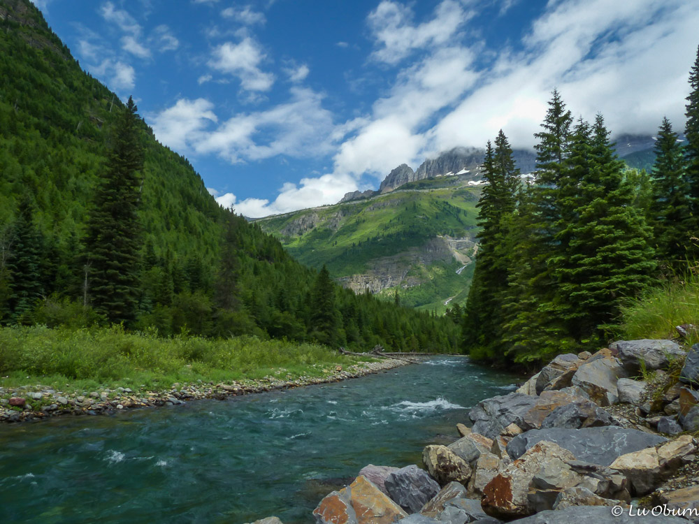
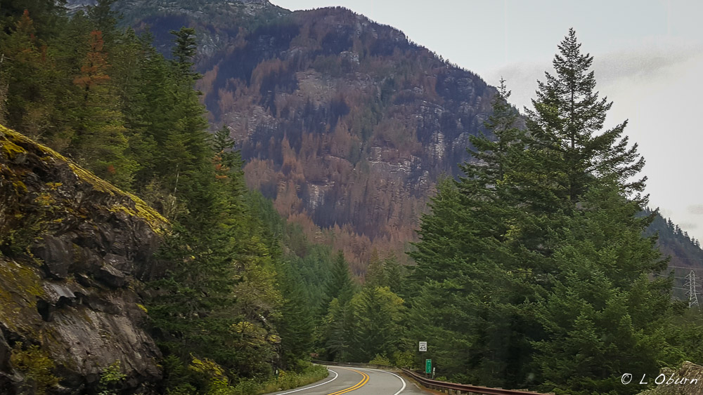
I thought our western mountains were breathtaking, but Canada really takes it up a notch with their Rockies, a beautiful melding of heaven and earth.  There is an unspoiled “wild-ness” here, thanks to the  ice-age glaciers acting as landscape sculptors, creating the rugged mountain ranges and gouging out the valley into a deep basin.

Spectacular glaciers and turquoise lakes above treeline on the Iceline Trail

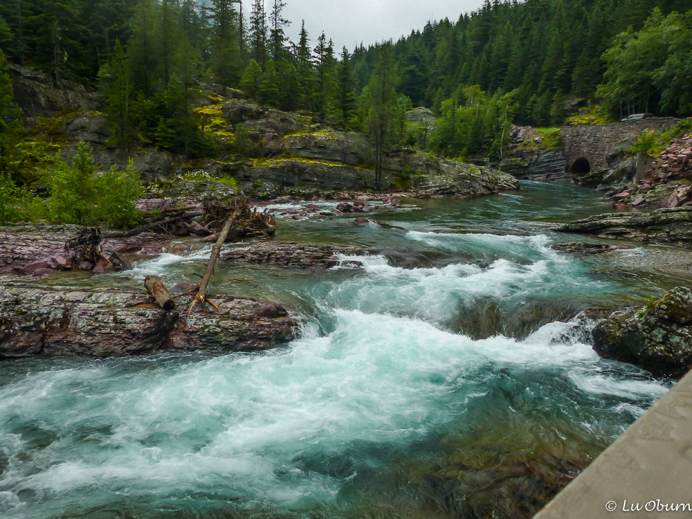
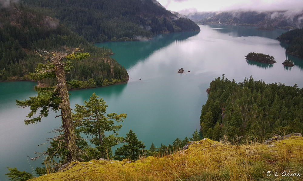
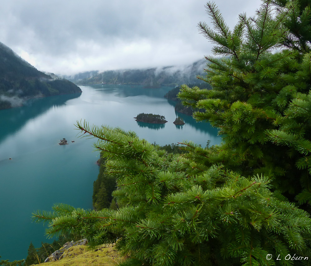
The glaciers that covered the Canadian Rockies have vastly retreated but have left behind vivid memories found flowing in the turquoise and jade green waters, unusual gorges and canyons, and unique rock formations.

The next morning we set out for the much smaller Yoho National Park, in the province of British Columbia, and the second Canadian National Park.  The unusual name for this park is a Cree expression meaning awe and wonder, which was exactly what we were feeling throughout our first hike in a Canadian park.

Although the smallest of the four parks that form the Canadian Rocky Mountain Parks UNESCO World Heritage Sites, it holds some of the oldest and most significant shale fossil beds in the world, as well as 36 peaks soaring above 10,000 feet.  It packs a punch!

Takakkaw Falls - 830 foot drop in one stretch and 1260 foot drop in total, among the highest in Canada
Takakkaw Falls – 830 foot drop in one stretch and 1260 foot drop in total, among the highest in Canada

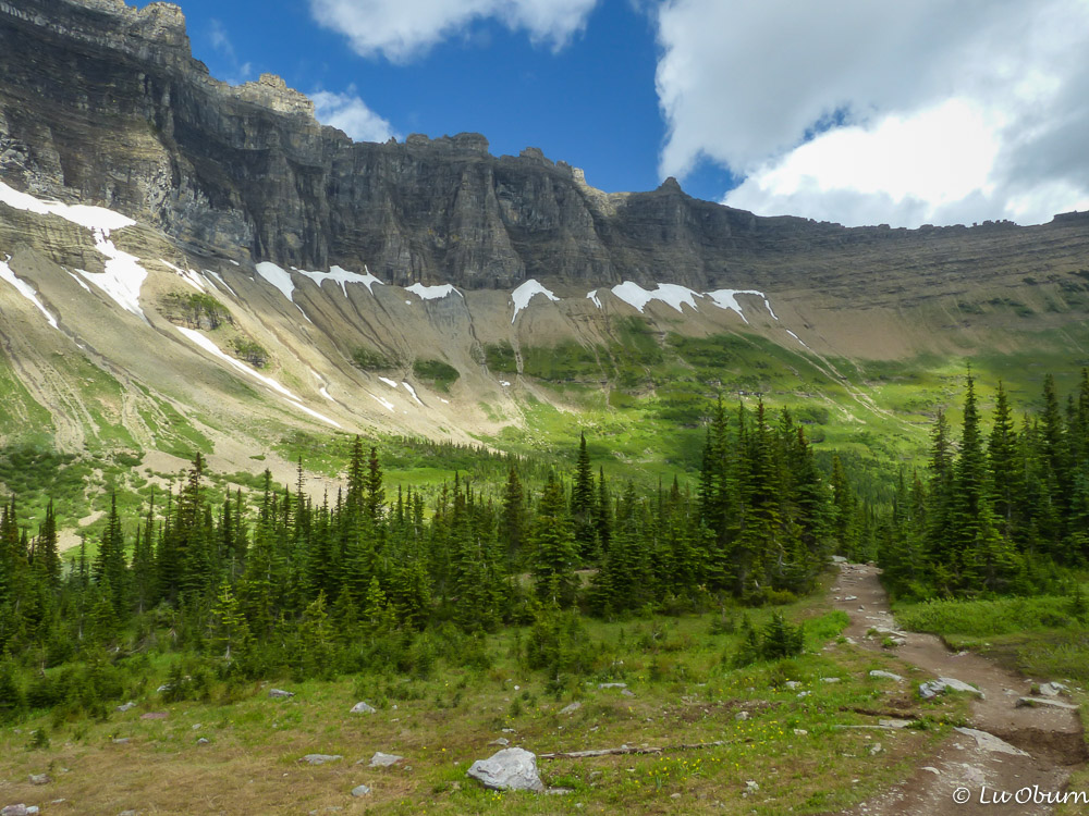
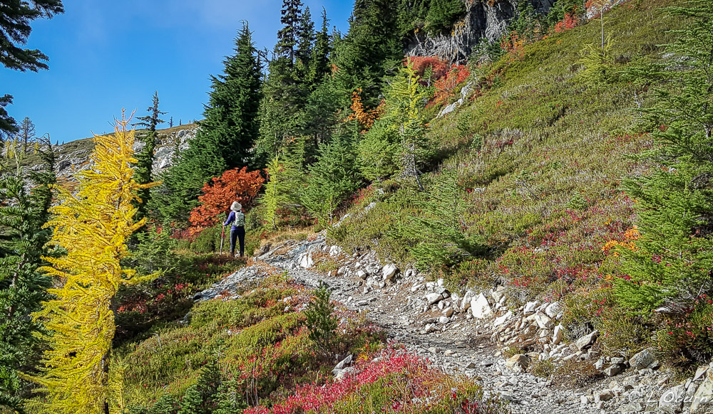
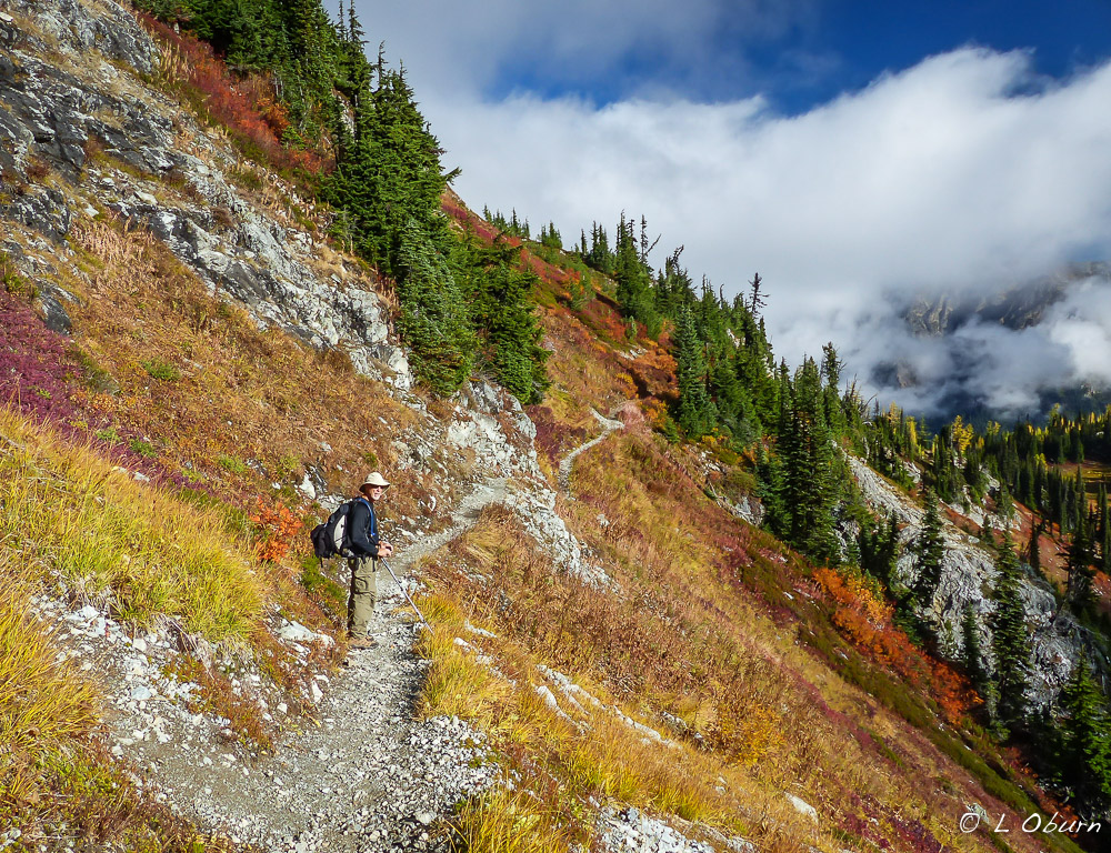
Since we had time for only one hike in Yoho, we chose a memorable hike, the Iceline Trail.  There are several ways to tackle this hike, out and back, a shorter loop and the big loop.  Guess which one I chose? 😉

Terry climbs to get a better view of Takakkaw Falls

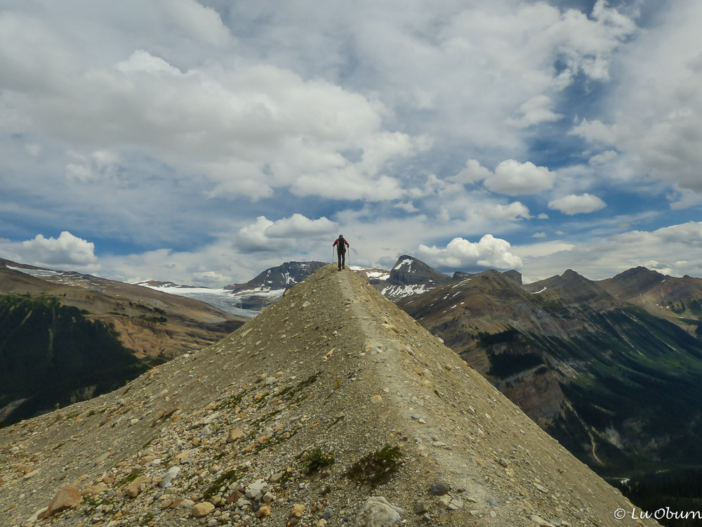
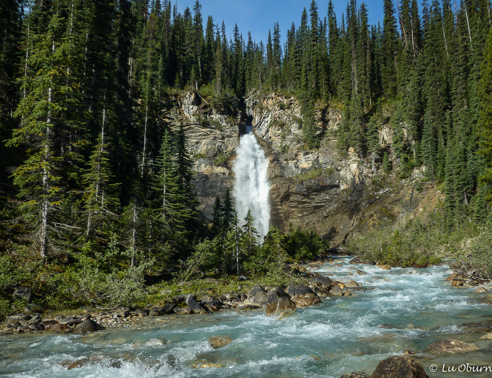
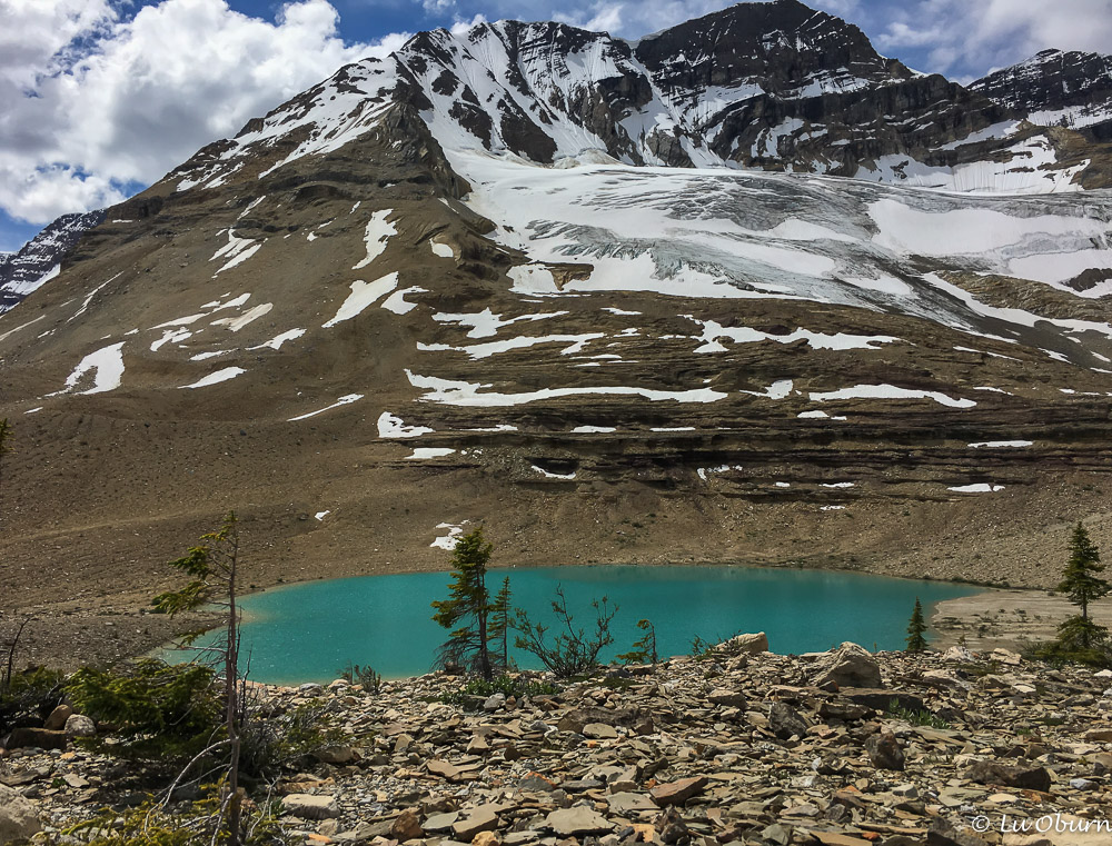
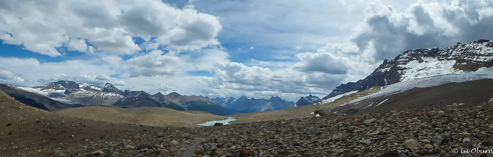
The Iceline Trail via Little Yoho (the big loop) is 13-miles, with many of those above treeline.  It’s roughly 3000′ of elevation gain made for a challenging hike, but the 360º views of glaciers, flowing streams, and one of the tallest waterfalls in all of Canada made it worth the effort.

One of the infamous red chairs found after completing the Iceline Trail.

The next day we decided to scale back our hiking and chose to hike the Lake Agnes Trail in Banff National Park to a European-style tea house, the highest tea house in all of Canada. It is probably the most “civilized” way to see the Rockies.  The trail is 4-miles round-trip, with a 1300 foot elevation gain, just enough for me after our previous day’s trek.

Lake Agnes tea house

And a visit to Banff is not complete without visiting the most iconic site in the park, the emerald waters of Lake Louise, where millions come every year to bask in her beauty.  It is the most famous glacial lake in the Canadian Rockies, named for Princess Louise Caroline Alberta, daughter to Queen Victoria.

The iconic Lake Louise

The world-famous Fairmont Chateau Lake Louise sits on the edge of the lake, striking an impressive pose.  And it looked like millions were there on the day we visited and none spoke our native tongue.

Fairmont Chateau Lake Louise

Enough though we visited during peak season and had little time to explore, we wouldn’t have passed on getting a glimpse into these two spectacular Canadian parks, and we will definitely be back.  I am already reading about Banff in the winter – snowmobiles, dog sleds, cross-country skiing, sleigh rides.  Sounds like fun, doesn’t it? Hubby is not convinced. 😉

Next Up:  Icefields Parkway

Quiet, Uncrowded Waterton Lakes National Park ~ Alberta, Canada

What started at an annual Rotary meeting between clubs in Montana and Alberta quickly blossomed into an international spirit of cooperation, a convergence of like values, celebrating the peace and goodwill between two nations with the longest globally undefended border.

Upper Waterton Lake
Upper Waterton Lake

In 1932 Waterton Lakes National Park and Glacier National Park joined together as Waterton-Glacier International Peace Park, the first of its kind.  The joint efforts of both the U.S. and Canada are reflected in their wildlife and vegetation management, search and rescue programs, and joint interpretive programs.  In 1995 Waterton-Glacier International Peace Park was designated a World Heritage Site.

In the 80+ years since, 138  international peace parks and similar protected transboundary areas have sprung up on five continents, some in the most combative corners of the globe.

Cameron Falls
Cameron Falls

While still in Glacier National Park I enrolled us for the International Peace Park Hike, an 8-mile hike along Upper Waterton Lake, which included a boat shuttle trip back from Goat Haunt.  Jointly led by a Glacier Park Ranger and Waterton Park Interpreter, this seemed the perfect way to begin our Canadian adventure.

Bright and early on a gray, cloudy day we headed for Waterton Lakes National Park, giving ourselves plenty of time, or so we thought, to purchase tickets at the marina and meet our guides at the trailhead.  Not aware of the road construction between Glacier and Waterton Lakes, the delays prevented us from arriving on time.  To placate my disappointment, Terry convinced me that a rainy, foggy day wasn’t the best time for a hike or a boat ride.  I reluctantly agreed.

Prince of Wales Hotel

We waited a couple of hours until the fog burnt off then proceeded to the same trailhead we missed earlier and hiked the Bertha Lake Trail, a 6.5-mile hike to an alpine lake.  The switchbacks seemed to never end, and at one point I remarked to Terry, “there had better be a damn fine lake and waterfall at the end of this trail”…and there was.

Bertha Falls
Bertha Falls
Bertha Lake
Bertha Lake

After a pizza/microbrew meal and a stroll around town, we decided, weather permitting, that a hike to Crypt Lake should be on the agenda for the next day.  It is rated by National Geographic as “one of the world’s most thrilling trails”.  Sadly it was a wash-out as the rains moved in and stayed for the day.  Nonetheless, we found Waterton Lakes to be a lovely little town, and vowed to return to finish the two hikes we had on the agenda.

“Shaped by wind, fire, and water, Waterton remains for all time a place of spectacular beauty, a Canadian legacy of mountains, lakes, prairies, forests, alpine meadows, and wildlife.”  Our visit to Canada may have gotten off to a soggy start, but an anticipated visit to friends put the sun right back into our days.

Next up:  Cochrane

“Crown of the Continent” ~ Glacier National Park

“A man who keeps company with glaciers comes to feel tolerably insignificant by and by.”  ~  Mark Twain

Imagine what the early explorers must have felt as they pushed their way across the Great Plains and saw a wall of mountains far in the distance.  Imagine their amazement as they moved further west and those mountains loomed ever larger, peaks bathed in sunlight, surrounded by long finger-like lakes and rushing streams.  As they moved deeper into the mountains, most likely bighorn sheep and mountain goats dotted the hillsides, while osprey and eagle glided overhead.  Huge glaciers clung to the cliffs of the Continental Divide, instilling a sense of awe and wonder.  Except for the swiftly retreating glacial ice, Glacier National Park still embodies much of this same spectacular scenery.

This was our first visit to Glacier and our 29th national park to add to our slow-growing list.  We have so much more to see!  This trip was long overdue, as two previously planned visits were thwarted due to family emergencies.  Our timing certainly wasn’t the best, this being the centennial – 100 years since President Woodrow Wilson signed legislation creating the new National Park Service.  Record numbers of tourists are descending upon the parks this year and Glacier was no exception. But neither the hordes nor the rainy weather dampened our spirits.

While perusing displays in a visitor center, we stumbled across some interesting and alarming statistics about the glaciers in this beautiful park.  In 1850 there were 150 glaciers; in 2010 only 25 remained. One placard we read claimed, “Current climate models suggest that all the glaciers in Glacier National Park will be gone by 2030.”  This is a powerful example of what will be lost without global action to reduce greenhouse gas emissions.

sperrydancer_web_5
“Changing Balance/Balancing Change” dancer superimposed on Sperry Glacier – photo credit nps.gov

Terry reminded me as I remarked about the high treelines on the mountains that this is yet another example of global warming.  As the treelines continue to rise, alpine areas will disappear. If this occurs, what will happen to the species that depend on them?  Certainly something to ponder.

One of the highlights of a visit to Glacier is traveling the Going-to-the-Sun Road, a 50-mile meandering road that combines both history and breathtaking scenery.  Many national parks we’ve visited have similar roads spanning their length and, while we have found all to be beautiful and unique, Glacier may take the top prize for those parks visited to date.

Plenty of time is needed to do this road justice, as the sights seem almost endless and the photo ops many.  The lush Garden Wall section will slow you down, as often there are vertical rock faces that jut out into the winding roadway, but it is a magnificent stretch of road, not to be missed.

Our top 3 picks of the park are shown below.  Granted, we didn’t see all this impressive national park has to offer, but everything we saw spoke to us.  What better way to describe such beauty than through photos.

1)  Going-to-the-Sun Road

Just a few magical moments found while “going to the sun”.

2)  Many Glacier

Situated in the northeastern corner of the park, it is often called the heart of Glacier.  It was our favorite and certainly touched our hearts.

3)  Hiking

More than 700 miles of trails meander through alpine meadows and creep up mountain passes.  Iceberg Lake Trail and Ptarmigan Tunnel were given high marks by friends.  Because both originated from the same trailhead and we had some gas left in our tanks after going to Iceberg Lake, we decided to trek to Ptarmigan Tunnel.  And boy, was it a trek!  This 15-mile combo trail, with about 3000 feet of elevation gain is a not-to-be-missed hike.  Be forewarned that once you get to Ptarmigan Lake, there is a series of long, steep switchbacks to trek before you arrive at the tunnel, but it would be a sin to stop at the lake.

We had also planned to hike to Grinnell Glacier, which has significantly retreated in recent decades, but time escaped us.  The wheels are already in motion for another Glacier visit. 🙂

Next Up:  Oh Canada, here we come!

“Les Trois Tetons” ~ Grand Teton NP

Fur trappers, when first gazing upon the Teton Range, dubbed the South, Middle, and Grand peaks “Les Trois Tetons”, meaning “the three breasts”.

With less than three days to explore one of nature’s finer creations, Grand Teton National Park, we knew we would be leaving much for another time.  A day of hiking and one dedicated to exploring the park’s beauty through a lens seemed the best approach. Fortunately this wasn’t our first visit so we didn’t feel compelled to maintain a crazed, frenetic pace.

Grand Teton NP_160622-1300642
Bison at Antelope Flats

Waiting in a long line at the entrance station, hubby turned to me and said “remind me why we decided to visit a national park during peak season and while the National Park Service is celebrating their centennial year”.  Yes, probably not our most prudent decision.  Shoulder season is typically our time for exploring these treasures but a planned visit to friends in the area and another adventure already scheduled for the fall found us rubbing elbows with hordes of tourists.

Grand Teton NP_160622-1300675
Grand Teton reflection on Jackson Lake

With map and park newspaper in hand we pulled away from the entrance station and were immediately reminded of why we are drawn to this park.  Without any rolling foothills to soften the visual effects, Grand Teton’s massive, craggy peaks rose dramatically off the Jackson Hole valley floor, a sight likely to leave most breathless.

Grand Teton NP_160622-1300480
Terry on the trail

The 2.7 billion-year-old rocks found in the core of this range are some of the oldest in North America, but these magnificent mountains rank among the youngest in the world.

After passing a couple of full campgrounds and another long wait, we quickly set up camp at Colter Bay.   With map and newspaper in hand we charted our course for the next two days.

The Forks of Cascade Canyon Trail at Jenny Lake became our hike of choice. Instead of taking the boat shuttle across the lake, an option for many as it shaves about four miles off the hike, we opted to start our trek from the String Lake trailhead.  It made for a nice 12.5-mile hike, with a 2000’ elevation gain.

We even got a peek at a moose feeding in the willows across a meadow, a wonderful treat. They have been known to dive up to 18 feet under the water’s surface and stay there for up to a minute, in search of aquatic plants, which makes for a rather uncooperative photography subject.

Grand Teton NP_160622-1300514
Moose munching on willows

The next morning found me rubbing sleep out of my eyes at 4:30 am, heading out in the hopes of capturing sunrise shots without the crowds.  Tucked into a warm bed, hubby graciously declined the offer to join me.

Both artists and photographers flock to the Tetons.  With her sagebrush flats, wet and alpine meadows, lakes, ponds, and forests, there is plenty available for a creative mind.

Grand Teton NP_160622-1300590
Moulton Barn on Mormon Row

A favorite stop to complete a wonderful day of sightseeing was the Laurance S. Rockefeller Preserve Center.  This plot of land south of the village of Moose offers 8 miles of trails and showcases Mr. Rockefeller’s vision and his legacy of conservation stewardship.  A small circular room allows you to quietly sit, enjoying the sounds of the park: crickets chirping, owls hooting, wolves howling, male ruffed grouse flapping his wings in courtship, an elk’s mating call, wind blowing through an aspen grove, a thunderstorm…ahhh!

Grand Teton NP_160622-1300658
Just me and my shadow at Oxbow Bend

Wind speaks through pines.  Light animates granite.  An eagle soars – it’s shadow crosses over us. All life is intertwined.  ~ Anonymous

 This is the connectedness felt when we quiet ourselves in nature.

The American Alps ~ North Cascades National Park

“Wilderness is a human concept…an idea about a place and its effect on us.  It is a state of mind devoted to an experience and the contemplation of natural places.”  ~ Unknown

As we headed northeast towards our next destination, I was reminded of how we once scoffed at tourists who would pull up to the visitor center at Yellowstone NP, saying they had three or four hours to spare, so what should they see.  Although we had three or four days to tour North Cascades National Park, I was feeling like one of those tourists trying to see the highlights in such a short time.  Smoke from the many fires devastating eastern Washington had moved back our visit so our available days to enjoy this park were shrinking and now we had rain moving into the picture as well…ugh!  But we knew that if time and weather permitted only one hike, a special trek was in our future.

With her spectacular craggy peaks, sheer-walled cliffs, spires, and pinnacles, many know North Cascades National Park as the “American Alps”.   Few roads lead into the park, so much of the beauty is best seen on her 400 miles of mountain and meadow trails, which could be why she is one of the least visited National Parks, receiving only 21,000 visitors in 2013.   The North Cascades National Park Service Complex consists of the National Park, Ross Lake National Recreation Area to the east and Lake Chelan National Recreation Area to the south.  Both of the Rec Areas receive more visitors.

As we neared the Visitor Center we were hit with the devastation caused by one of the Washington fires.  Had it not been for the road acting as a firebreak and the actions of the brave firefighters, the Visitor Center would have been lost.

After being mesmerized by the glaciers hugging Mt. Rainier’s peaks I was anxious to lay eyes on some in this park.  I learned that the North Cascades is home to a whopping 318 moving ice masses.  More than 1/3 of all glaciers in the U.S. call this land home.  It’s no wonder the streams and creeks are crystal clear, and the rivers and lakes are beautifully colored with glacial runoff.

Although we loved our time in the San Juans, we sorely missed long mountain hikes.  A warm-up seemed to be logical before our grand adventure so I chose the 7.5-mile Diablo Lake Trail.  With not too much elevation gain, it seemed like a great precursor hike.  However, a very narrow, winding road stood between the trailhead and us so we parked further away and elected to hike the Diablo Dam Trail to our trailhead.

As we came off the final switchback, on our way back to the truck, my “finance hubby” started to add up the numbers.  It seems our warm-up hike topped off at over 10 miles and Terry is now thinking I have adopted our friend Pam’s approach to hiking.  I wouldn’t have it any other way. 😉

If I had one complaint about North Cascades National Park, this would be it.  I struggle with the many dams that have been carved out of the wild rivers and bedrock.  When the dams turned Skagit River into tamer lakes, it dramatically altered the life of the gorge, wildlife in both water and on land bearing the greatest suffering.  It is difficult to take a photo without capturing many power lines running across the frame.  I reflected on something I had read recently – “if the wilderness disappears, will the wildness remain”?

The next day the dreaded storm front arrived.  Although we basked in early autumn sun at the Lone Fir Campground, the mountains towering above us told a different tale, shrouded with gray clouds.  A road trip to Mazama was added to the agenda as we waited out the mountain storm.  This teeny little village is a cross-country skier haven, with many already taking to the roads on roller blades and poles in hand, practicing for a much-anticipated winter of groomed trails.

Unfortunately the storm refused to move on quickly so we were faced with another day of rain and cloud cover.  Although hiking in the rain is never out of the question, the cloud cover was worrisome as mountain views could be obliterated.  We opted to hang back one more day.  Another road trip took us to Diablo Lake Overlook, where many brochure photos I had seen were taken, as well as Washington Pass, a must-see in our opinion for gorgeous mountain peak views.  Winthrop, a quaint little mountain town, became our lunch stop at the Old Schoolhouse Brewery.

Diablo Lake Overlook
Washington Pass
Washington Pass

Thank goodness we woke to blue skies the next day, as our time in the North Cascades was dwindling.  We arrived at the trailhead by 8:00 am to a brisk 38º for our much-anticipated hike on the Maple Pass trail . With so few roads in the park, many of the mountain passes much be seen and traversed on foot, and Maple Pass is one of those.

If time limits you to one hike in the North Cascades Complex, this should be the one. We’d heard this from friends Jim and Gayle and had it reinforced by many since then.

The views are drop-dead gorgeous, with low clouds draping the mountains, stunning views of glaciers from just above the pass, glacier-kissed mountain lakes, and brilliant fall colors that took my breath away.  Well, maybe the 7.5 miles and 2100’ elevation gain had a bit to do with that.

I'm in awe at the glorious vistas before me.
I’m in awe at the glorious vistas before me.
Rainy Lake
Rainy Lake
Heading back down the trail

Standing looking out over the glorious mountain peaks, I couldn’t help but feel a connectedness with the entire Universe.  What a remarkable feeling!

Next Up: Idaho Visit with Friends